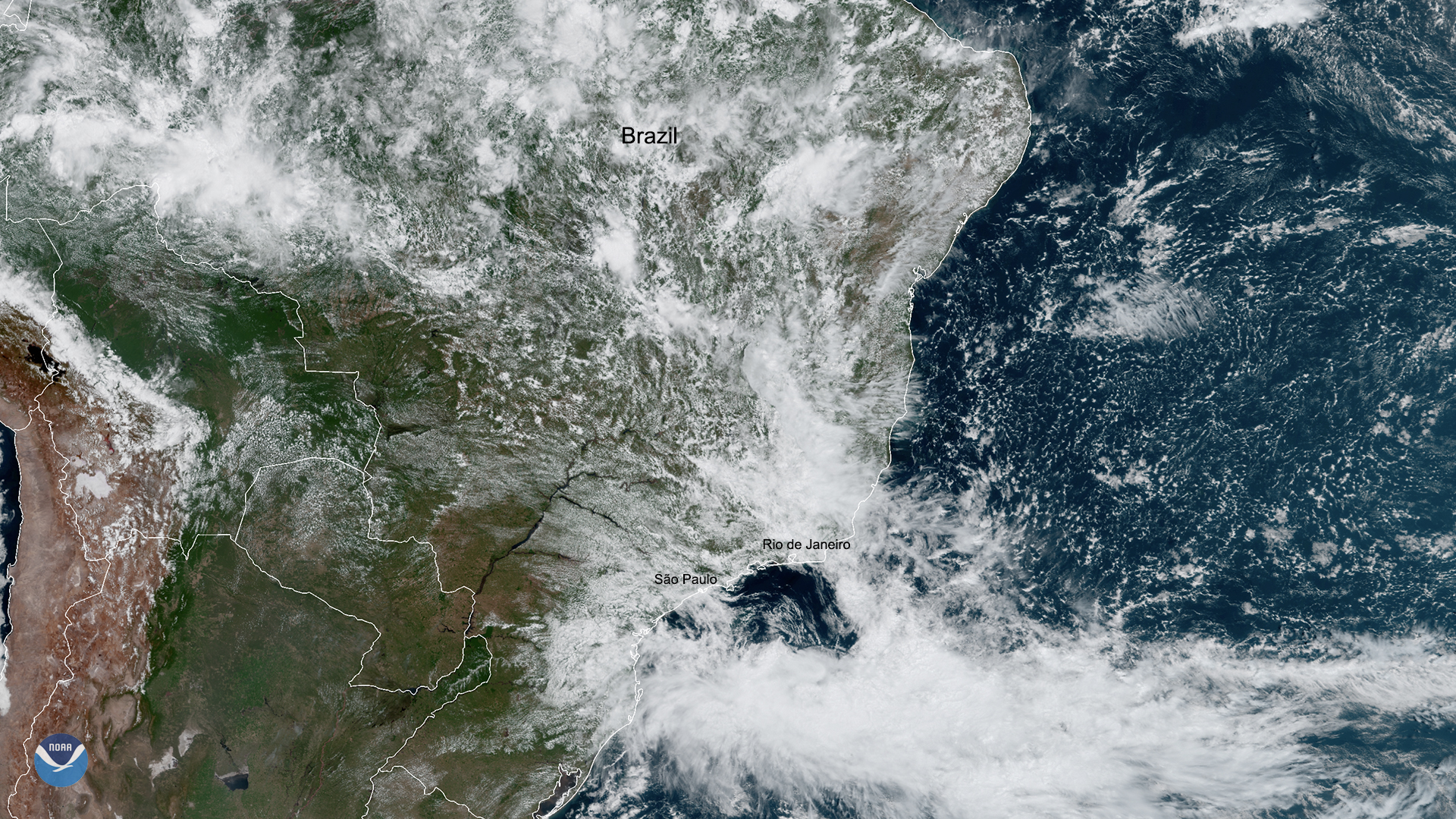
Download Image Download satellite image of Brazil
On March 4, 2020, GOES-East saw an ongoing storm system over the coast and interior of Brazil. According to Brazil’s National Meteorological Institute (INMET), February 2020 was the rainiest month in the last 77 years forSao Paulo, beating out the previous record that was set in 1995. Ongoing weather conditions in the country continue to cause massive landslides, flooding, and strong winds. Western portions of the state of Minas Gerais (395 miles northwest of Rio de Janeiro) reported precipitation amounts that were close to their historical February average, in addition to suffering devastating floods in January.
Rio de Janeiro’s site for Operational Defense stated that “between midnight on Sunday and Monday [morning], it rained more than half the average for the month of March across the city. In [nearby] Santa Cruz, it rained six inches in just 32 hours, just under the March seasonal average for the entire month.”
INMET added that there will be continuing instability in the region due to the formation of a low pressure system in the ocean, together with deep moisture streaming into Southeastern Brazil. Isolated light-to-moderate showers will occur in the region until Wednesday evening, providing some relief from the mudslides and debris that resulted from the weekend’s heavy rain. Unfortunately, 23 people are confirmed dead ,and governmental authorities expect thedeath toll to rise as search and rescue operations continue.
The GOES-East geostationary satellite, also known as GOES-16, keeps watch over most of North America, including the continental United States and Mexico, as well as Central and South America, the Caribbean, and the Atlantic Ocean to the west coast of Africa. The satellite's high-resolution imagery provides optimal viewing of severe weather events, including thunderstorms, tropical storms, and hurricanes.
Where this page came from
This page was imported from NOAA Satellites (NESDIS). Published by NOAA's National Environmental Satellite, Data, and Information Service and, as a work of the United States government, in the public domain; pictures credited elsewhere are left out.
Nobody has written it yet — it is the source material at a new address, which is why search engines are asked to skip it and why no one earns from it. It is up for grabs: take it on, and it is yours to rewrite and to earn from.
Licence: CC0 1.0 (public domain) · Adapted from www.nesdis.noaa.gov
1
0
0
0

Comments