Download Image Download Image of Download Image
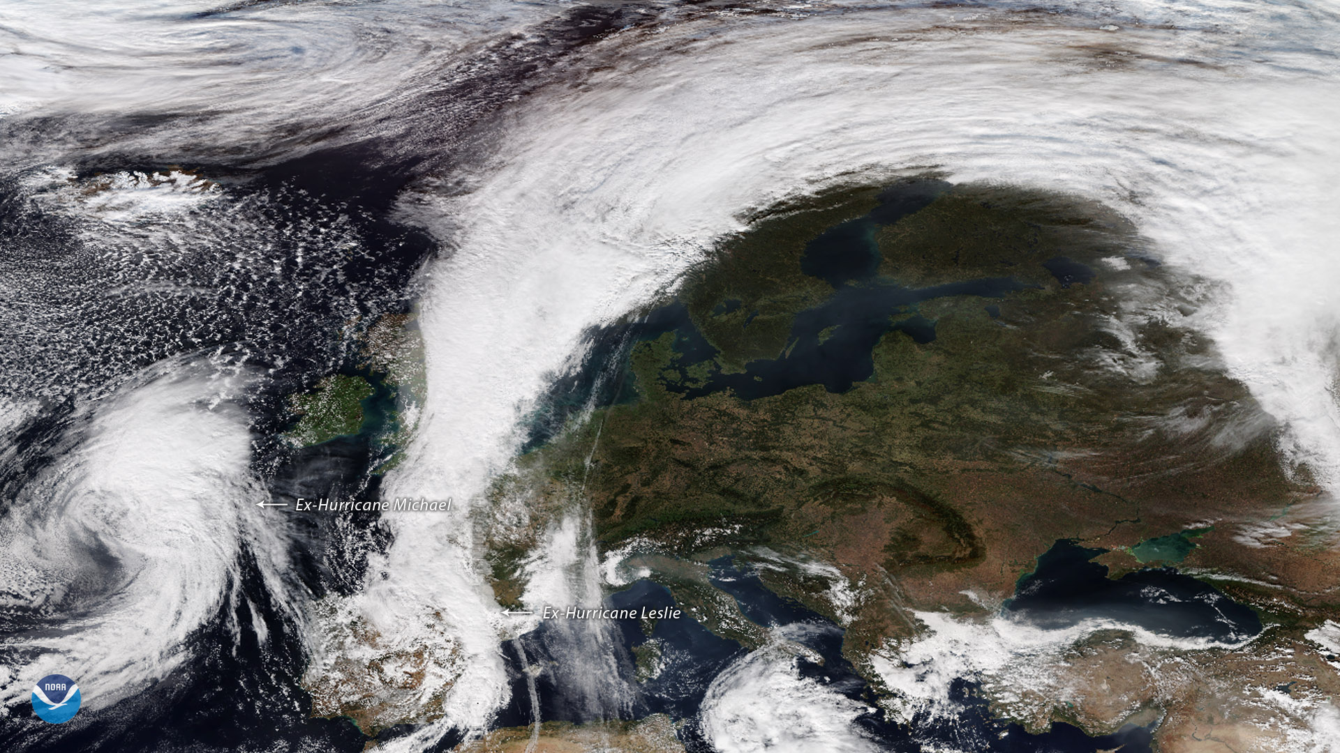
The remnants of two Atlantic hurricanes, Michael and Leslie, have reached the shores of western Europe. On October 14, 2018, the NOAA-20 satellite's VIIRS instrument captured this true-color image of former Hurricane Leslie over the Iberian Peninsula, as well as ex-hurricane Michael, which is heading toward northwestern Spain less than a week after the storm devastated the Florida Panhandle and the southeastern U.S.
Michael has lost its tropical characteristics and is not expected to bring major impacts as it moves southeastward toward Spain. The Iberian Peninsula already endured another storm over the weekend, after Leslie ââ¬â which had been meandering through the Atlantic since September 23 ââ¬â slammed into the coast of Portugal as a rare post-tropical cyclone.
Though no longer a tropical system at landfall, Leslie brought gale-force winds and heavy rain as it came ashore around 5:30 p.m. EDT on October 13. The storm had sustained 70 mph winds at landfall, with a peak gust as high as 109 mph. Just hours before reaching the Portuguese coast, Leslie was still a Category 1 hurricane, making it one of only a handful of hurricanes ever seen so far east in the Atlantic during the historical record. After tracking over the Iberian Peninsula, moisture from Leslie's remnants dumped torrential rains over southern France, where flash flooding killed at least 13 people, according to media reports.
In this satellite image we can see the clouds from ex-hurricane Leslie over the Iberian Peninsula merging with a north-south oriented cold front over western France. While extensive cloud cover stretches from Spain to Norway, clear skies dominate central and eastern Europe, where a sprawling high pressure system brought unusually warm October temperatures as far north as central Scandinavia yesterday.
Where this page came from
This page was imported from NOAA Satellites (NESDIS). Published by NOAA's National Environmental Satellite, Data, and Information Service and, as a work of the United States government, in the public domain; pictures credited elsewhere are left out.
Nobody has written it yet — it is the source material at a new address, which is why search engines are asked to skip it and why no one earns from it. It is up for grabs: take it on, and it is yours to rewrite and to earn from.
Licence: CC0 1.0 (public domain) · Adapted from www.nesdis.noaa.gov
1
0
0
0

Comments