Download Image Download Image of North America
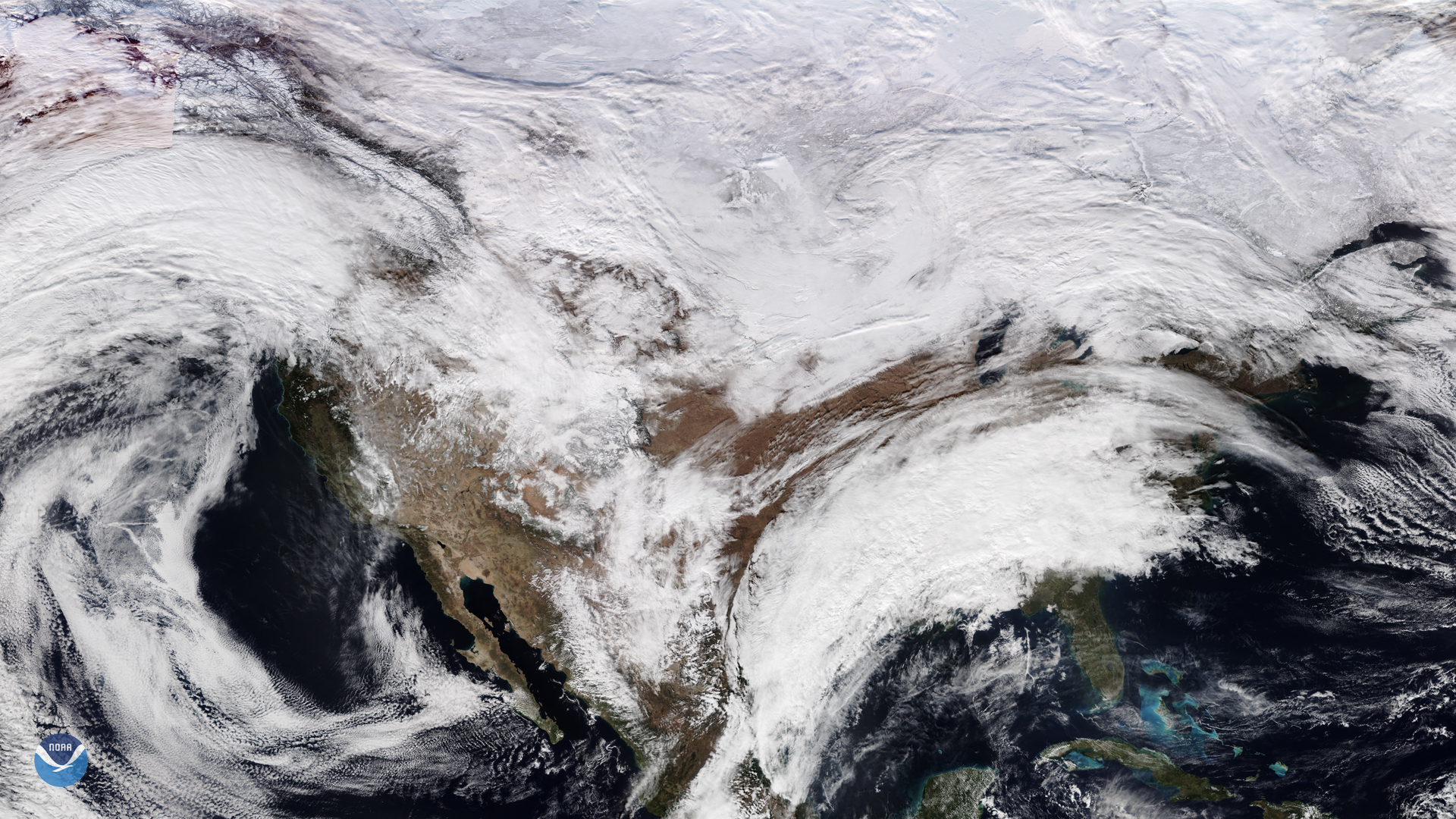
For those who like to stargaze, sometimes weather on Earth can literally get in the way of seeing beyond its atmosphere. The Quadrantid Meteor Shower, an event that happens yearly in January, is typically the least visible due to the relatively low luminosity of the meteors and its short peak viewing time. This year, International Meteor Society (IMO) scientists have determined that North America is optimally placed to observe the showers. However, this NOAA-20 satellite image from Jan. 2, 2020 shows that an upper-level trough over the central U.S. will move over the East and interact with a couple of fronts, resulting in ongoing precipitation and cloud cover for much of that region. For the Pacific Northwest, a strong frontal system will bring snow and other forms of precipitation, especially for higher altitudes.
The only places where clear skies are forecast on Jan. 3–4 will be in the American Southwest, within the rough geographic boundaries of Brownsville, Texas to the south, Colorado Springs, Colo. to the north, Barstow, Calif. to the west and San Antonio, Texas to the east. Temperatures, however, are going to vary wildly, from a high of 74 degrees Fahrenheit in Brownsville to a low of 21 degrees Fahrenheit in Colorado Springs. Scientists at the IMO predict the shower to be at peak activity on Jan. 4, 3:00 a.m. EST. The IMO elaborates that “the first quarter Moon (Jan. 3) will set near local midnight and ...leave good viewing conditions.” Those interested in outside viewing of the event should take care to dress appropriately and to find dark sites with little to no light pollution to occlude the event.
This image was captured by the NOAA-20 satellite's VIIRS instrument, which scans the entire Earth twice per day at a 750-meter resolution. Multiple visible and infrared channels allow it to detect atmospheric aerosols, such as dust, smoke and haze associated with industrial pollution and fires. The polar-orbiting satellite circles the globe 14 times daily and captures a complete daytime view of our planet once every 24 hours. Images taken by the VIIRS sensor during each orbit are then merged together to create image mosaics of larger regions, like the one used here.
Where this page came from
This page was imported from NOAA Satellites (NESDIS). Published by NOAA's National Environmental Satellite, Data, and Information Service and, as a work of the United States government, in the public domain; pictures credited elsewhere are left out.
Nobody has written it yet — it is the source material at a new address, which is why search engines are asked to skip it and why no one earns from it. It is up for grabs: take it on, and it is yours to rewrite and to earn from.
Licence: CC0 1.0 (public domain) · Adapted from www.nesdis.noaa.gov
1
0
0
0

Comments