Download Image Download Image of Great Lakes Region
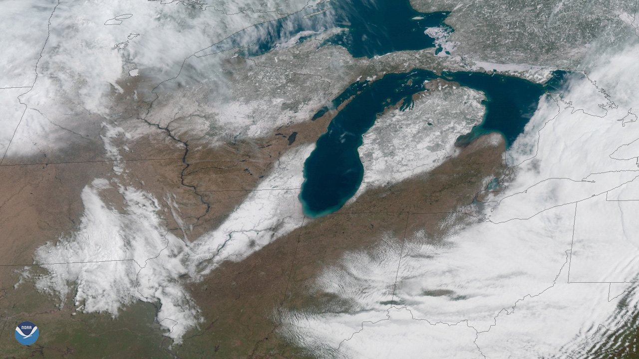
Nothing says spring quite like a little bit of mid-April snow, right? A swath of snow stretches from central Illinois to northeast Michigan in this April 15, 2019, view from GOES East. While Chicago is no stranger to snow in April, yesterday’s total for O’Hare International Airport reached 5.3 inches, making it the second snowiest calendar day on record for this late in the season. The National Weather Service in Chicago noted on Twitter that the record of 5.4 inches was set on April 16, 1961.
The dose of winter weather also led to thousands of flight cancelations in the Chicago-area and prompted the Chicago Cubs to postpone their game against the Los Angeles Angelson on Sunday, according to local media reports.
While the cold air that got caught behind the recent blizzard generally dropped anywhere from 3 to 6 inches of snow across portions of the Great Lakes region, there were a few impressive snow totals. Sylvester, Mich. led the way with 9.1 inches, while Big Rapids, Mich., and Union Grove, Wisc. came in a close second with 9 inches.
This GeoColor-enhanced imagery was created by NOAA's partners at the Cooperative Institute for Research in the Atmosphere. The GOES East geostationary satellite, also known as GOES-16, provides high-resolution atmospheric imagery of Earth's Western Hemisphere, including North and South America, from 22,000 miles in space.
Where this page came from
This page was imported from NOAA Satellites (NESDIS). Published by NOAA's National Environmental Satellite, Data, and Information Service and, as a work of the United States government, in the public domain; pictures credited elsewhere are left out.
Nobody has written it yet — it is the source material at a new address, which is why search engines are asked to skip it and why no one earns from it. It is up for grabs: take it on, and it is yours to rewrite and to earn from.
Licence: CC0 1.0 (public domain) · Adapted from www.nesdis.noaa.gov
1
0
0
0

Comments