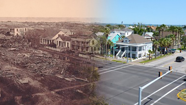
Download Image Download Image of the Galveston Hurricane damage
It’s been less than a month since Hurricane Laura hit Louisiana and east Texas, but 120 years ago today, another historic storm brought devastation to the same region.
Around 8:00 p.m. CST on Sept. 8, 1900, the Great Galveston hurricane, also known as the Great Storm of 1900, wreaked havoc along a large portion of eastern Texas and made landfall as a Category-4 storm in the city of Galveston. With a massive storm surge of more than 15 feet that inundated the city and its surrounding areas, along with winds that reached more than 130 mph, the storm did more than $20M in damage.) (~$617M in 2020 USD) and destroyed more than 3,600 buildings. It is also considered the deadliest natural disaster in U.S. history, that left at least 8,000 people dead.
Although U.S. Weather Bureau forecasters were aware of the storm as early as August 30, they believed it would continue to track northeast. However, once in the Gulf of Mexico, it strengthened and veered westward. According to NOAA, wireless ship-to-shore communications were not yet available, so there was no way to know when and where the hurricane would strike.
Afterward, the citizens of Galveston rebuilt the town, achieving a remarkable feat of civil engineering. They not only raised the grade of the entire city by jacking up buildings and raising utility lines, but also built a seawall to help protect it, which has been added to over the years. Today, it measures 16 feet at the base, rises 17 feet, and spans more than 10 miles of coastline.

An image of Galveston, TX, captured by the GOES-East satellite on Sept. 4, 2020.
The main image above is a then-and-now composite, showing Galveston after the Great Galveston hurricane compared to how it looks in modern times.
Where this page came from
This page was imported from NOAA Satellites (NESDIS). Published by NOAA's National Environmental Satellite, Data, and Information Service and, as a work of the United States government, in the public domain; pictures credited elsewhere are left out.
Nobody has written it yet — it is the source material at a new address, which is why search engines are asked to skip it and why no one earns from it. It is up for grabs: take it on, and it is yours to rewrite and to earn from.
Licence: CC0 1.0 (public domain) · Adapted from www.nesdis.noaa.gov
1
0
0
0

Comments