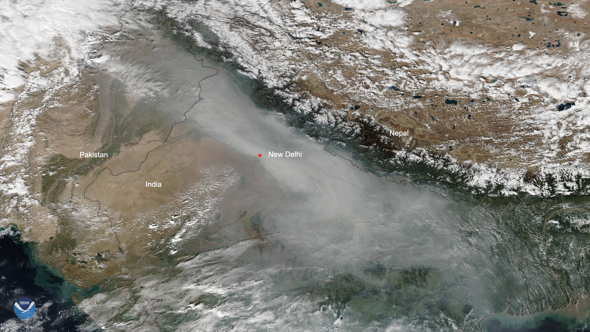
Air quality levels in India’s capital city of New Delhi reached the “severe plus” level on Friday, prompting the government to declare a public health emergency, according to local news reports. Thick smog lingers over the city, which is home to more than 25 million people, in this Oct. 31, 2019, true-color imagery from the NOAA-20 polar-orbiting satellite.
“Delhi has turned into a gas chamber due to smoke from crop burning in neighbouring sic] states,” Delhi’s Chief Minister Arvind Kejriwal [tweeted on Thursday. Schools in the area were forced to closed until Nov. 5 because of the toxic pollution, but as Kejriwal notes in his tweet, the government is distributing free face masks to children through public and private schools in the city.
India, and New Delhi in particular, have grappled with poor air quality for years. In a 2018 list of the world’s most polluted cities in terms of air quality, 25 of the top 50 cities — including New Delhi — are located in India. Air pollution in this region typically peaks around this time of year, partially due to fireworks from the Hindu festival of Diwali, according to the Associated Press.

Smog chokes northern India in this NOAA-20 imagery from December 2018. In the imagery above, air quality had reached the “severe” level, so the smog isn’t quite as thick as in the Oct. 31, 2019 imagery.
India’s Central Pollution Board noted that air quality is expected to marginally improve over the weekend, although levels may remain in the upper end of the “very poor” category. Until the air quality improves, India’s government is urging residents in New Delhi and surrounding suburbs to avoid outdoor activities.
This image was captured by the NOAA-20 satellite's VIIRS instrument , which scans the entire Earth twice per day at a 750-meter resolution. Multiple visible and infrared channels allow it to detect atmospheric aerosols, such as dust, smoke and haze associated with industrial pollution.
Where this page came from
This page was imported from NOAA Satellites (NESDIS). Published by NOAA's National Environmental Satellite, Data, and Information Service and, as a work of the United States government, in the public domain; pictures credited elsewhere are left out.
Nobody has written it yet — it is the source material at a new address, which is why search engines are asked to skip it and why no one earns from it. It is up for grabs: take it on, and it is yours to rewrite and to earn from.
Licence: CC0 1.0 (public domain) · Adapted from www.nesdis.noaa.gov
1
0
0
0

Comments