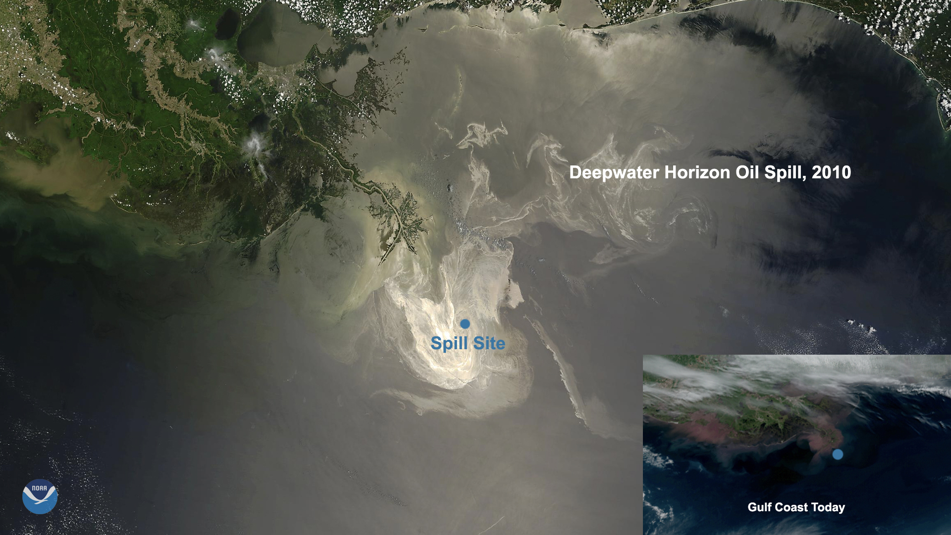
Today, the GOES-East satellite viewed the Gulf Coast (inset) which suffered a devastating oil spill from the Deepwater Horizon oil rig on April 20, 2010. NESDIS was instrumental in detecting the damaged rig’s oil spill impact and reach, thanks to its Satellite-Derived Surface Oil Analysis Products and the Satellite Analysis Branch (SAB) Marine Pollution Program deployed later that year. NASA’s MODIS instrument aboard the Terra and Aqua satellites also monitored the spill’s progression (large image), which lasted just under three months.
The Deepwater Horizon rig ejected 3.2 million barrels of oil across more than 1,500 miles of coastline and 47,000 square miles of open water, equal to the size of the state of Virginia. In 2016, the spill was judged by the federal government to be the responsibility of the oil rig’s owners and operators, who were fined 20 billion dollars for the environmental damage. In the 10 years since the event, several federal and state agencies have become trustees of the cleanup and environmental monitoring in the area.
According to NOAA Fisheries , one of the three goals of the cleanup project’s eventual success involves ongoing data collection that will assist restoration, monitoring, and progress towards recovery. To that end, NESDIS has been instrumental in supplying NOAA’s Natural Resource Damage Assessment teams with data points on the Gulf’s current state of health, including satellite tracking of sperm whales and sea turtles native to the region, sediment movement from the Gulf of Mexico’s shores, and more.
The GOES-East geostationary satellite, also known as GOES-16, keeps watch over most of North America, including the continental United States and Mexico, as well as Central and South America, the Caribbean, and the Atlantic Ocean to the west coast of Africa. The satellite's high-resolution imagery provides optimal viewing of severe weather events, including thunderstorms, tropical storms, and hurricanes.
Where this page came from
This page was imported from NOAA Satellites (NESDIS). Published by NOAA's National Environmental Satellite, Data, and Information Service and, as a work of the United States government, in the public domain; pictures credited elsewhere are left out.
Nobody has written it yet — it is the source material at a new address, which is why search engines are asked to skip it and why no one earns from it. It is up for grabs: take it on, and it is yours to rewrite and to earn from.
Licence: CC0 1.0 (public domain) · Adapted from www.nesdis.noaa.gov
1
0
0
0

Comments