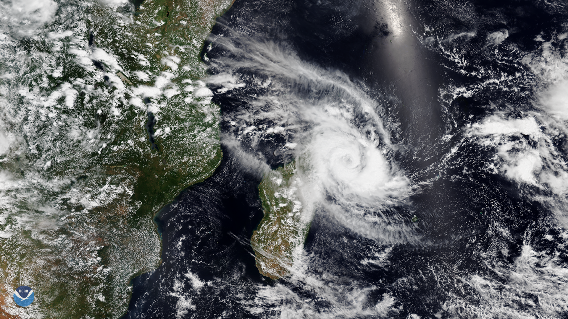
The NOAA-20 satellite, on March 15, 2020, saw Tropical Cyclone Herold over the northeastern shores of Madagascar, as it headed southeastward toward the Mascarene Islands, which includes the islands of Mauritius, Réunion, and Rodrigues. As of March 16, a warning have been put into effect for Mauritius, and government officials in Réunion suggest that residents keep a vigilant watch on developments over the next few days. First estimated to have wind speeds up to 80 miles per hour, it has been downgraded to 75 miles per hour for the next 24 hours, with Meteo France adding the caveat that “even this estimate may be a little high.”
This part of the world has already experienced significant weather events in the last four months, with Tropical Cyclone Belna causing great concern for Madagascar in Dec. 2019 and Tropical Cyclone Francisco targeting the smaller island nation of Mauritius in Feb. 2020. Weather patterns that influence heavy rain and drought, such as the Indian Ocean Dipole (IOD) from NovembertoApril, contribute to extreme variations from East Africa to the Australian coastline. While in its positive phase, the IOD brings heavy rain to the west-lying regions of East Africa, but also causes scorching dryness for Australia in the east, generating the perfect conditions for bushfires to take place. For places like Madagascar and La Réunion, rain is the source of the majority of freshwater available; any unforeseen variation can easily become “a matter of life or death.”
This image was captured by the NOAA-20 satellite's VIIRS instrument , which scans the entire Earth twice per day at a 750-meter resolution. Multiple visible and infrared channels allow it to detect atmospheric aerosols, such as dust, smoke, and haze associated with industrial pollution and fires. The polar-orbiting satellite circles the globe 14 times daily and captures a complete daytime view of our planet once every 24 hours.
Where this page came from
This page was imported from NOAA Satellites (NESDIS). Published by NOAA's National Environmental Satellite, Data, and Information Service and, as a work of the United States government, in the public domain; pictures credited elsewhere are left out.
Nobody has written it yet — it is the source material at a new address, which is why search engines are asked to skip it and why no one earns from it. It is up for grabs: take it on, and it is yours to rewrite and to earn from.
Licence: CC0 1.0 (public domain) · Adapted from www.nesdis.noaa.gov
1
0
0
0

Comments