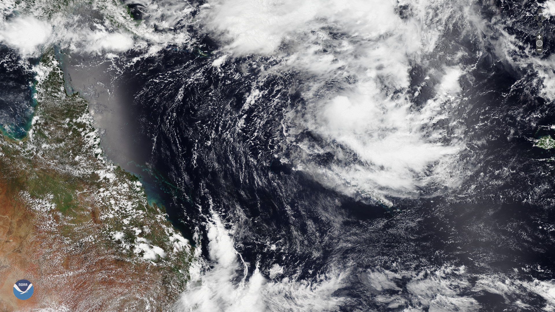
Download Image Download Image of the Tropical Cyclone Uesi
A relatively stationary tropical low south of the Solomon Islands has developed into a tropical cyclone after drifting slightly southward and intensifying on Sunday, Feb. 10, 2020. The storm was named Tropical Cyclone Uesi by the Fiji Meteorological Service.
According to the last update from the Joint Typhoon Warning Center , Uesi is approximately 382 miles west of Port Vila, Vanuatu, and is tracking southwestward at roughly 7 mph with maximum sustained winds around 70 mph and gusts of about 85 mph. This is equivalent to a strong tropical storm in the Atlantic and Eastern Pacific basins.
Occasional downpours are expected to continue across the northern Vanuatu islands through the beginning of the week, and the storm is expected to strengthen due to a favorable environment of low wind shear and warm water. Meteorologists forecast that it will bring heavy rain and strong winds as it moves toward northwestern New Caledonia. Forecast models also suggest it may potentially head toward eastern Australia toward the end of the week as it weakens.

The still image above was captured by the NOAA-20 satellite's VIIRS instrument , which scans the entire Earth twice per day at a 750-meter resolution. Multiple visible and infrared channels allow it to detect atmospheric aerosols, such as dust, smoke and haze associated with industrial pollution and fires. The polar-orbiting satellite circles the globe 14 times daily and captures a complete daytime view of our planet once every 24 hours.
The image loop was captured by the Advanced Himawari Imager (AHI) on Japan’s Himawari-8 satellite. This satellite, the first unit of the Japan Meteorological Agency's (JMA) third-generation of geostationary satellites, provides visible light and infrared images of the Asia-Pacific region. Himawari's data are vital for global geostationary coverage, which is why NOAA and JMA have agreed to mutual back-up arrangements for their geostationary systems.
Where this page came from
This page was imported from NOAA Satellites (NESDIS). Published by NOAA's National Environmental Satellite, Data, and Information Service and, as a work of the United States government, in the public domain; pictures credited elsewhere are left out.
Nobody has written it yet — it is the source material at a new address, which is why search engines are asked to skip it and why no one earns from it. It is up for grabs: take it on, and it is yours to rewrite and to earn from.
Licence: CC0 1.0 (public domain) · Adapted from www.nesdis.noaa.gov
1
0
0
0

Comments