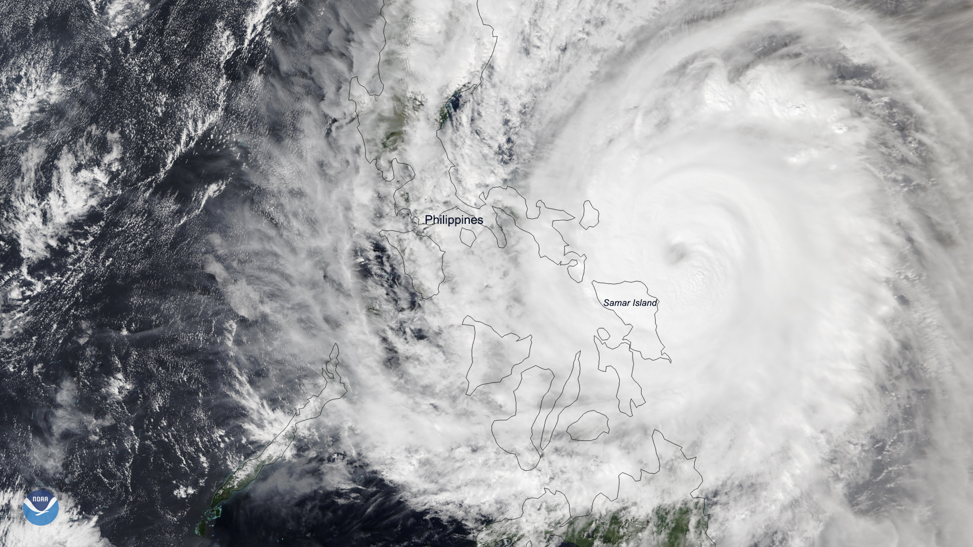
Download Image Download Image of Typhoon Kammuri
A rare late-season typhoon is bringing heavy rain and strong winds to the eastern islands of the Philippines. Typhoon Kammuri made landfall over Gubat, Sorsogon at 11:00 p.m. local time (10:00 a.m. ET) according to the Philippine Atmospheric, Geophysical and Astronomical Services Administration. The storm is the 20th storm to hit the Philippines this year, and was given the local name “Tisoy” as it entered the Philippine Area of Responsibility.
The storm has developed a broad 34-mile-wide eyewall that is lashing areas spanning from Catanduanes to Camarines Sur and south past Northern Samar. With current maximum sustained wind speeds at roughly 132 mph and gusts around 160 mph, it is now the equivalent of a Category 4 Atlantic hurricane on the Saffir-Simpson Hurricane Wind Scale.
More than 43,000 people have been evacuated and schools in six provinces have suspended classes while local governments began preparing for the storm’s arrival. Residents were urged to check local weather advisories and government social media accounts for updates.
Additionally, there are concerns that the storm may affect the 2019 Southeast Asian Games , which the Philippines is hosting. More than 8,000 athletes from 11 participating nations are expected to participate in the games, which began on Saturday. Organizers of the event said they are fully prepared to employ contingency measures as necessary.
This image was captured by the NOAA-20 satellite's VIIRS instrument , which scans the entire Earth twice per day at a 750-meter resolution. Multiple visible and infrared channels allow it to detect atmospheric aerosols, such as dust, smoke and haze associated with industrial pollution and fires. The polar-orbiting satellite circles the globe 14 times daily and captures a complete daytime view of our planet once every 24 hours. Images taken by the VIIRS sensor during each orbit are then merged together to create image mosaics of larger regions.
Where this page came from
This page was imported from NOAA Satellites (NESDIS). Published by NOAA's National Environmental Satellite, Data, and Information Service and, as a work of the United States government, in the public domain; pictures credited elsewhere are left out.
Nobody has written it yet — it is the source material at a new address, which is why search engines are asked to skip it and why no one earns from it. It is up for grabs: take it on, and it is yours to rewrite and to earn from.
Licence: CC0 1.0 (public domain) · Adapted from www.nesdis.noaa.gov
1
0
0
0

Comments