Viu algo para melhorar? Proponha uma alteração.

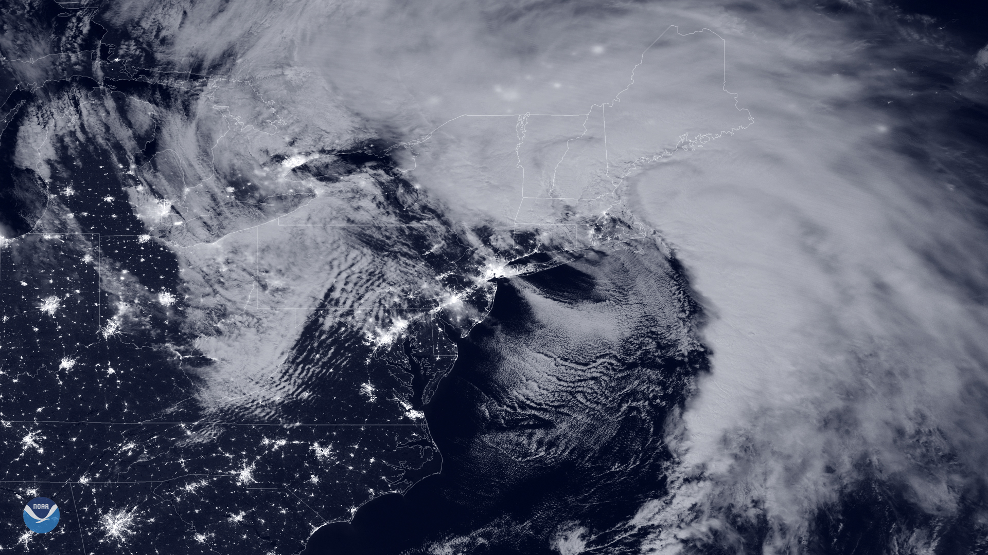
Download Image Download Image of the Bomb Cyclone over the Northeast
A dangerous nor’easter parked over New England delivered a powerful punch to the region this week. A nor’easter is essentially a storm system that’s defined by both its location and the direction from which its strongest winds blow. This nor’easter also meets the criteria to be considered a “bomb cyclone” because of how quickly the storm intensified. A bomb cyclone is defined as a mid-latitude cyclone whose minimum central air pressure drops at least 24 millibars in 24 hours. In fact, this storm dropped more than 30 millibars in less than 24 hours, and set low-pressure records for the month of October in Boston, Providence, R.I., and Portland, Maine.
The powerful coastal system, seen in this NOAA-20 day-night band imagery from early on Oct. 17, 2019, is bringing the Northeast very heavy rainfall and damaging winds capable of toppling power lines. The National Weather Service ( NWS ) in Boston reported overnight wind gusts of 90 mph in Provincetown, Mass. Those powerful wind gusts left nearly half a million people in Massachusetts and Maine without power as of 11 a.m. ET. Across Connecticut, New Hampshire, New York and Rhode Island, more than 100,000 homes and businesses woke up to darkness, according to poweroutage.us. High wind warnings and wind advisories remain in effect from coastal Virginia to Massachusetts.
While the nor’easter is expected to quickly lift into eastern Canada by tomorrow, rain and snow may linger across parts of interior New England through Friday, according to the NWS. As this system moves out, the NWS says folks from the Appalachians to the Northeast can expect to see temperatures dip 10-20 degrees below normal for October.
The VIIRS day-night band layer is created using a sensing technique designed to capture low-light emissions under varying illumination conditions and is displayed as a gray-scale image. A higher signal-to-noise ratio compared with the Suomi NPP satellite's day-night band results in sharper imagery.
Where this page came from
This page was imported from NOAA Satellites (NESDIS). Published by NOAA's National Environmental Satellite, Data, and Information Service and, as a work of the United States government, in the public domain; pictures credited elsewhere are left out.
Nobody has written it yet — it is the source material at a new address, which is why search engines are asked to skip it and why no one earns from it. It is up for grabs: take it on, and it is yours to rewrite and to earn from.
Licença: CC0 1.0 (domínio público) · Adaptado de www.nesdis.noaa.gov
1
0
0
0

Comentários