Viu algo para melhorar? Proponha uma alteração.

Download Image Download Image of two large storm systems over North America
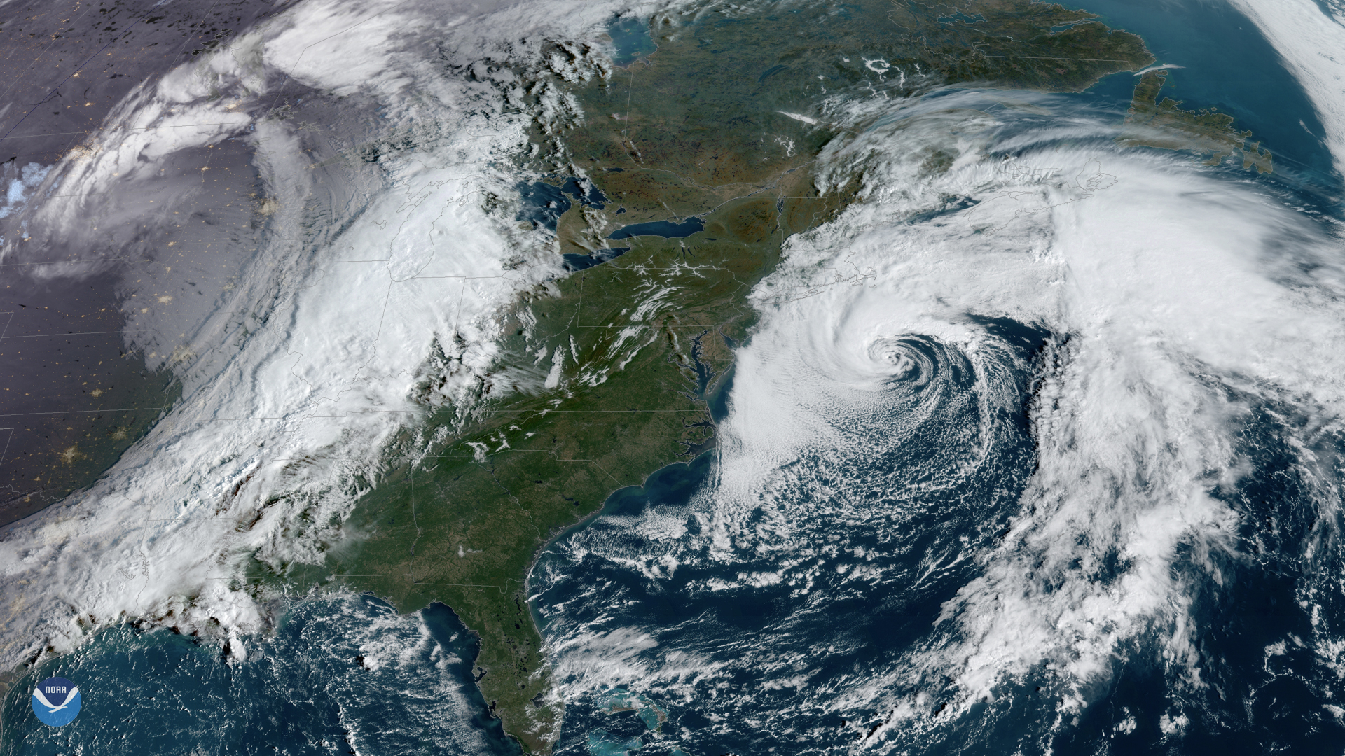
GOES East captured this awe-inspiring view of two large storm systems over North America on Friday, Oct. 11, 2019.
To the west, a powerful cold front responsible for the coldest air so far this season is pushing eastward into the Plains and the Midwest. This air is moving into a much warmer, more humid air mass to the east, causing a massive row of fast-moving thunderstorms to form along the sharp temperature gradient.
Off the East Coast, a former nor’easter centered southeast of New England has now become Subtropical Storm Melissa. It is currently bringing rain and some wind to coastal areas of Massachusetts, as high pressure across eastern Canada is blocking it from moving closer to land. The storm is expected to move away from the coast Friday night as it slowly weakens.
The GOES East geostationary satellite, also known as GOES-16, keeps watch over most of North America, including the continental United States and Mexico, as well as Central and South America, the Caribbean, and the Atlantic Ocean to the west coast of Africa. The satellite's high-resolution imagery provides optimal viewing of severe weather events, including thunderstorms, tropical storms, and hurricanes.
Where this page came from
This page was imported from NOAA Satellites (NESDIS). Published by NOAA's National Environmental Satellite, Data, and Information Service and, as a work of the United States government, in the public domain; pictures credited elsewhere are left out.
Nobody has written it yet — it is the source material at a new address, which is why search engines are asked to skip it and why no one earns from it. It is up for grabs: take it on, and it is yours to rewrite and to earn from.
Licença: CC0 1.0 (domínio público) · Adaptado de www.nesdis.noaa.gov
1
0
0
0

Comentários