Viu algo para melhorar? Proponha uma alteração.

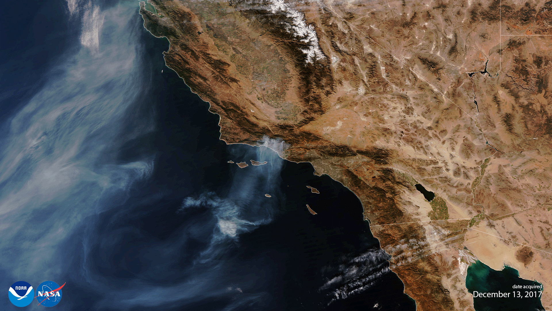
Download Image Download Image of fires in California
Two years ago on May 30, 2018, NOAA announced that its JPSS satellite, NOAA-20, its first next-generation polar-orbiting weather satellite, was fully operational. Launched on Nov. 18, 2017, the satellite first completed six months of what is called “on-orbit checkout,” a time-intensive process where its systems were tested and its sensors activated and calibrated.
Note to screen-readers: This page is using an IFrame for the content-area, and you screen reader may not be abel to see it on this website.
For screen-reading purposes, please go directly to the IFrame's target page by going to
https://www.youtube.com/embed/GJtEGtbfJ34.
Originally called JPSS-1, the satellite was renamed NOAA-20 after it reached orbit. NOAA-20 is the first weather satellite in the Joint Polar Satellite System (JPSS) , a collaborative program between NOAA and NASA. It lies in the same orbit path as the SuomiNationalPolar-orbitingPartnership (Suomi-NPP) satellite, which was launched in 2011 and previously served as NOAA’s primary polar-orbiting weather satellite.
The two satellites work together as they orbit the Earth 14 times a day to make up for any coverage gaps, providing full global coverage twice a day. Data and observations gathered by NOAA-20 help improve the accuracy of weather models and forecasts while providing vital coverage of polar regions.
The image above is the first True Color rendering of data from NOAA-20’s Visible Infrared Imaging Radiometer Suite (VIIRS) instrument, which showed the Thomas wildfire on Dec. 13, 2017, one of the largest in California’s history. It was taken as part of the satellite’s on-orbit checkout process. VIIRS scans the entire planet twice per day at a 750-meter resolution; multiple visible and infrared channels allow it to detect atmospheric aerosols such as dust, smoke, and haze.
Where this page came from
This page was imported from NOAA Satellites (NESDIS). Published by NOAA's National Environmental Satellite, Data, and Information Service and, as a work of the United States government, in the public domain; pictures credited elsewhere are left out.
Nobody has written it yet — it is the source material at a new address, which is why search engines are asked to skip it and why no one earns from it. It is up for grabs: take it on, and it is yours to rewrite and to earn from.
Licença: CC0 1.0 (domínio público) · Adaptado de www.nesdis.noaa.gov
1
0
0
0

Comentários