Viu algo para melhorar? Proponha uma alteração.

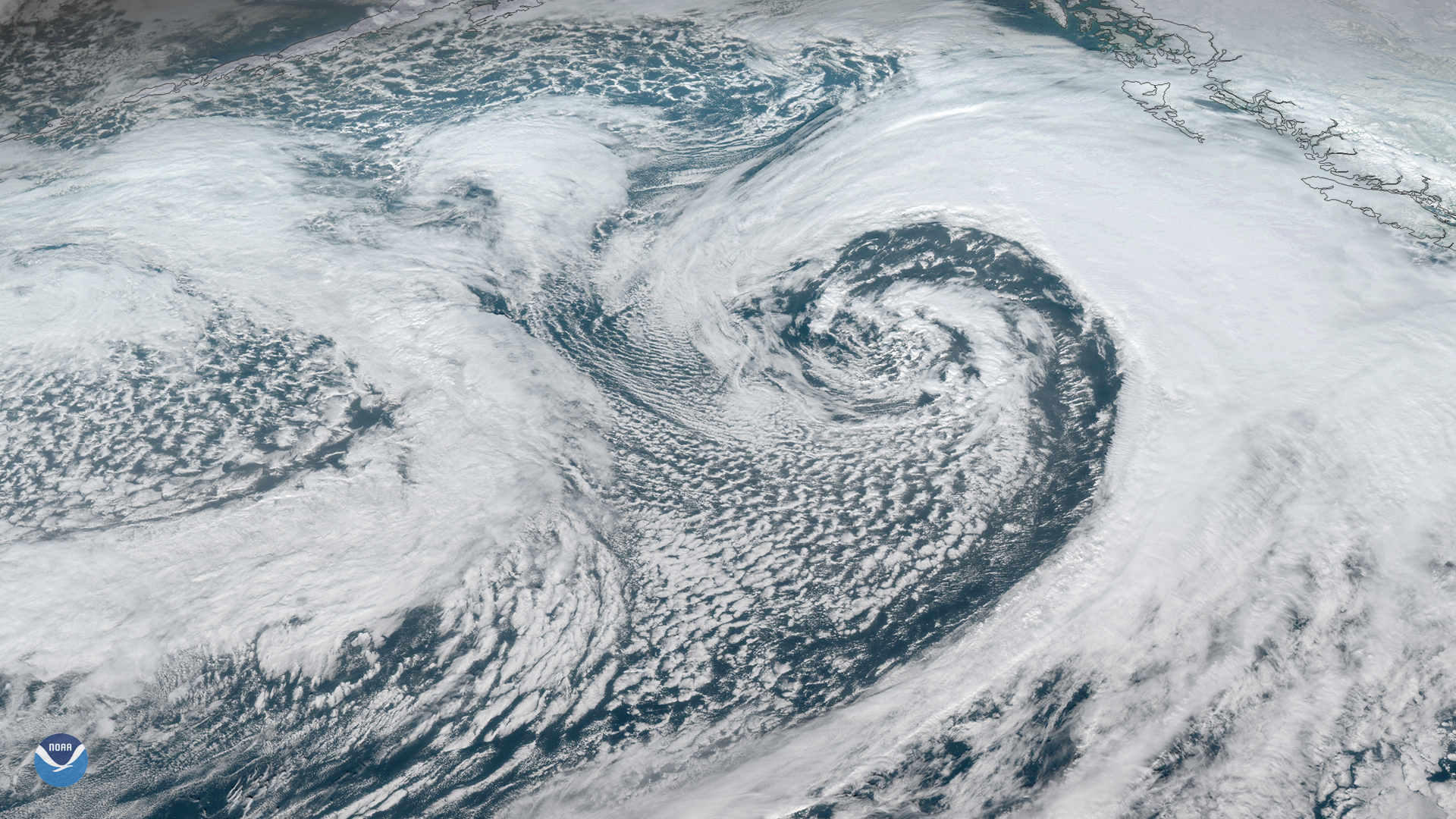
Download Image Download Image of Southern Alaska
A strong area of low pressure is moving northward across Alaska’s eastern Aleutian Islands and western Peninsula. The system is bringing snow and high winds, along with warming temperatures to parts of the state as it heads toward St. Lawrence Island and the Seward Peninsula.
The National Weather Service (NWS) issued a high wind warning for parts of Alaska's Eastern Range through early Tuesday. According to the service’s Alaska Weather Online , wind gusts reached up to 86 mph in Turnagain Arm and McHugh Creek on Monday, and 50–60 mph in the higher elevations of Anchorage and the Eastern Alaska Range.
NWS stated that the high wind warning will remain in effect until 6 p.m. local time Tuesday, and that people in the area should be wary of possible power outages and avoid traveling or being outside near areas with trees and branches. The alert also warns that the strongest winds will be through mountain passes and that heavy snowfall is expected along the Richardson Highway south of Black Rapids, with 6–8 inches possible.
Speaking of snow, NWS Anchorage has issued a Winter Storm Warning for Anchorage until 5 a.m. Wednesday, with heavy snow and accumulations of 6–12 inches expected. Although the winds will bring temperatures reaching nearly 40 degrees Fahrenheit, the Anchorage Daily News indicates that the warmth likely won’t be around long enough to melt much of snowpack.
Alaska Weather Online also mentioned that a new storm on Wednesday will likely spread more gale-force winds and a marked change in temperature with rain spanning the Alaska Peninsula through Kodiak Island.
This GeoColor enhanced imagery was created by NOAA's partners at the Cooperative Institute for Research in the Atmosphere. The GOES West satellite, also known as GOES-17, provides geostationary satellite coverage of the Western Hemisphere, including the United States, the Pacific Ocean, Alaska and Hawaii. First launched in March 2018, the satellite became fully operational in February 2019.
Where this page came from
This page was imported from NOAA Satellites (NESDIS). Published by NOAA's National Environmental Satellite, Data, and Information Service and, as a work of the United States government, in the public domain; pictures credited elsewhere are left out.
Nobody has written it yet — it is the source material at a new address, which is why search engines are asked to skip it and why no one earns from it. It is up for grabs: take it on, and it is yours to rewrite and to earn from.
Licença: CC0 1.0 (domínio público) · Adaptado de www.nesdis.noaa.gov
1
0
0
0

Comentários