Есть что улучшить? Предложите правку.

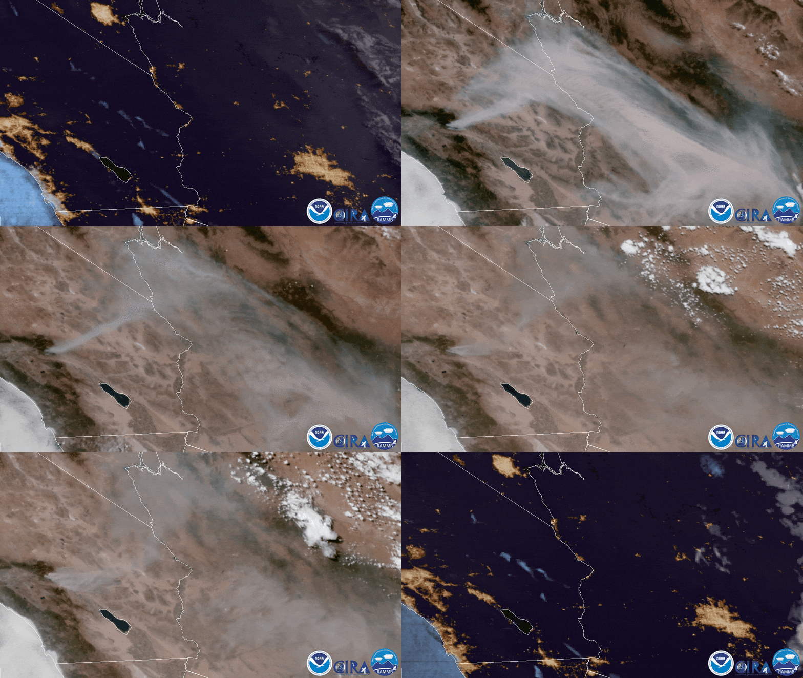
Download Image Download gif of smoke over California
Over the course of several hours on August 2, 2020, NOAA’s GOES-West satellite viewed the Apple Fire in Riverside County, California, shown above. The blaze began on July 31 as a scattering of smaller fires over less than a square mile, but by the afternoon of August 1, it had spread to over seven square miles , thanks in large part to increasing winds along with relatively low humidity. As of Monday morning, the blaze had grown to 31 square miles , with 5% contained, and more than 2,200 emergency responders working on the ground. The GeoColor animation shows how the smoke has blanketed the area, along with pyro cumulus clouds that resulted from the blaze.

A thin veil of smoke from the Apple Fire was also spotted several hundred miles away in southwestern Arizona by the NOAA-20 satellite’s Day/Night Band , seen above. Along with the smoke, the satellite is able to detect the light emitted from the blaze, which has been highlighted in yellow to separate it from the illumination of the city lights around southern California.
This GeoColor enhanced imagery was created by NOAA's partners at the Cooperative Institute for Research in the Atmosphere. The GOES-West satellite, also known as GOES-17, provides geostationary satellite coverage of the Western Hemisphere, including the United States, the Pacific Ocean, Alaska, and Hawaii. Also, the second image was captured by the NOAA-20 satellite's VIIRS instrument , which scans the entire Earth twice per day at a 750-meter resolution. Multiple visible and infrared channels allow it to detect atmospheric aerosols, such as dust, smoke, and haze associated with industrial pollution and fires.
Where this page came from
This page was imported from NOAA Satellites (NESDIS). Published by NOAA's National Environmental Satellite, Data, and Information Service and, as a work of the United States government, in the public domain; pictures credited elsewhere are left out.
Nobody has written it yet — it is the source material at a new address, which is why search engines are asked to skip it and why no one earns from it. It is up for grabs: take it on, and it is yours to rewrite and to earn from.
Лицензия: CC0 1.0 (общественное достояние) · По материалам www.nesdis.noaa.gov
1
0
0
0

Комментарии