Есть что улучшить? Предложите правку.

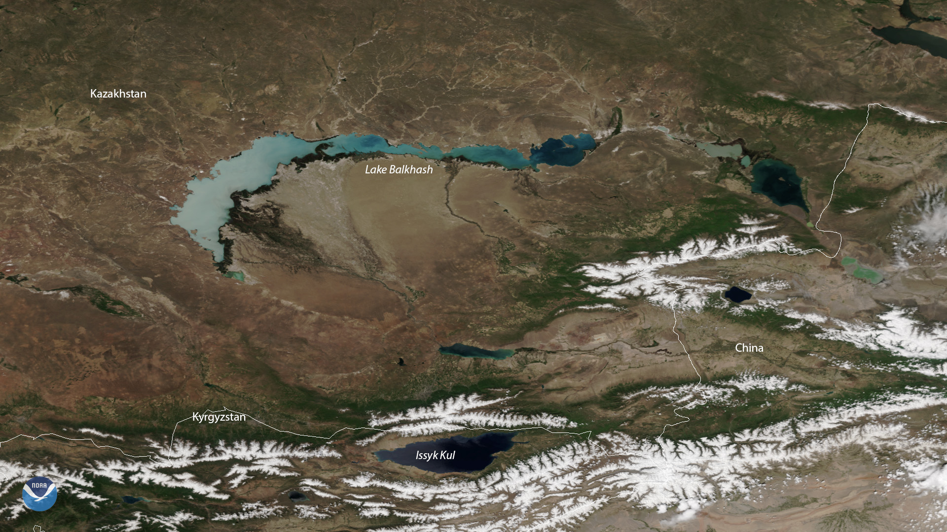
Download Image Download Satellite Image of Lake Balkhash
Spanning approximately 6,900 square miles, Lake Balkhash in Kazakhstan is one of the largest lakes in Asia and the 15th largest in the world. On May 28, 2019, the NOAA-20 satellite captured this stunning cloud-free view of the lake, which is located in southeastern Kazakhstan.
The Saryesik Peninsula, located to the left of the Lake Balkhash label in this imagery, divides the body of water “into two separate hydrologic parts.” The western part of the lake is wider and contains almost fresh water that’s suitable for consumption, whereas the eastern part of the lake is much more narrow and saltier.
Although true-color images like this may appear to be photographs of Earth, they aren't. They are created by combining data from the three color channels on the VIIRS instrument sensitive to the red, green and blue (or RGB) wavelengths of light into one composite image. In addition, data from several other channels are often also included to cancel out or correct atmospheric interference that may blur parts of the image.
Where this page came from
This page was imported from NOAA Satellites (NESDIS). Published by NOAA's National Environmental Satellite, Data, and Information Service and, as a work of the United States government, in the public domain; pictures credited elsewhere are left out.
Nobody has written it yet — it is the source material at a new address, which is why search engines are asked to skip it and why no one earns from it. It is up for grabs: take it on, and it is yours to rewrite and to earn from.
Лицензия: CC0 1.0 (общественное достояние) · По материалам www.nesdis.noaa.gov
1
0
0
0

Комментарии