Есть что улучшить? Предложите правку.

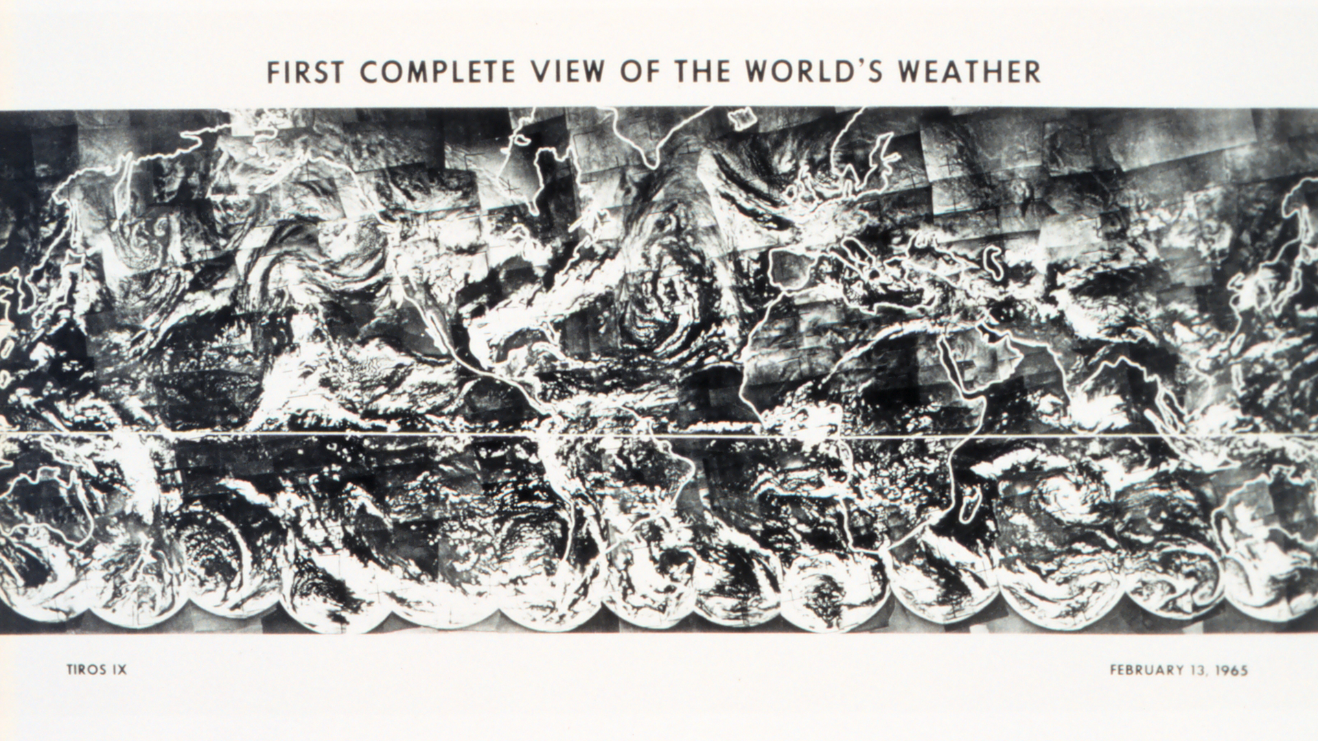
Download Image Image of the earth from TIROS
Today, NOAA's network of Earth-observing satellites capture some 20 terabytes of environmental data every day as they orbit the planet, and the imagery they collect is digitally merged to create the seamless and stunning views we see and use to study our world.
However, 60 years ago today, the TIROS IX satellite took 450 individual photographs, which were assembled together to create the first ever photomosaic image of the world's cloud cover. Please note the edges of the landmasses have been highlighted for clarity.

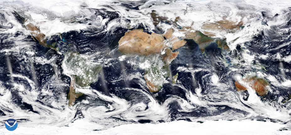
TrueColor imagery via NOAA-21 from Feb. 12, 2025.
Download Image Image of the earth
Compare this to the above image, taken on Feb. 12, 2025, by the polar-orbiting NOAA-21 satellite. What a difference a few decades makes!
The NOAA-21 satellite's VIIRS instrument scans the entire Earth twice per day at a 750-meter resolution. Multiple visible and infrared channels allow it to detect atmospheric aerosols, such as dust, smoke and haze associated with industrial pollution and fires. For more than a decade, the JPSS satellites, have each orbited the Earth from the North to the South Pole 14 times a day, flying over every spot on the planet at least twice.
The TIROS-IX satellite was launched on Jan. 22, 1965, and followed a near-polar orbit, circling the world every two hours so that it could cover the entire daylight portion of the planet. The satellite was equipped with two television camera systems, along with radiometers that measured radiation from the Earth. The spacecraft spun like a gyroscope to keep stable and remained operational until 1967, when its cameras were no longer able to provide useful images.
Where this page came from
This page was imported from NOAA Satellites (NESDIS). Published by NOAA's National Environmental Satellite, Data, and Information Service and, as a work of the United States government, in the public domain; pictures credited elsewhere are left out.
Nobody has written it yet — it is the source material at a new address, which is why search engines are asked to skip it and why no one earns from it. It is up for grabs: take it on, and it is yours to rewrite and to earn from.
Лицензия: CC0 1.0 (общественное достояние) · По материалам www.nesdis.noaa.gov
1
0
0
0

Комментарии