Есть что улучшить? Предложите правку.

Download Image Download image of suspended matter
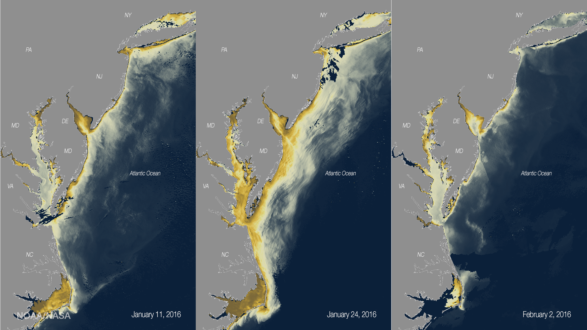
As rainwater washes off the land into coastal waters, it often transports sediments and can stir up bottom sediments on the coast. This process can create murky conditions knows as “turbidity,” which can be measured by the VIIRS sensor on the Suomi NPP satellite. This set of images shows how the Blizzard of January 2016 affected the turbidity of East Coast waters. The image on the left was captured before the storm (January 11), the middle image shows the day after the storm passed over the East Coast (January 24), and the image on the right is the following week (February 2). The darker beige/brown colors indicate more turbid water conditions. As the storm passed through the Mid-Atlantic, the high turbidity was caused by a combination of snow-fall on the water and high easterly winds that churned shelf waters bringing sediment to the surface from the bottom.
Where this page came from
This page was imported from NOAA Satellites (NESDIS). Published by NOAA's National Environmental Satellite, Data, and Information Service and, as a work of the United States government, in the public domain; pictures credited elsewhere are left out.
Nobody has written it yet — it is the source material at a new address, which is why search engines are asked to skip it and why no one earns from it. It is up for grabs: take it on, and it is yours to rewrite and to earn from.
Лицензия: CC0 1.0 (общественное достояние) · По материалам www.nesdis.noaa.gov
1
0
0
0

Комментарии