Есть что улучшить? Предложите правку.

Download Image Download Image of a Sparkly Night View
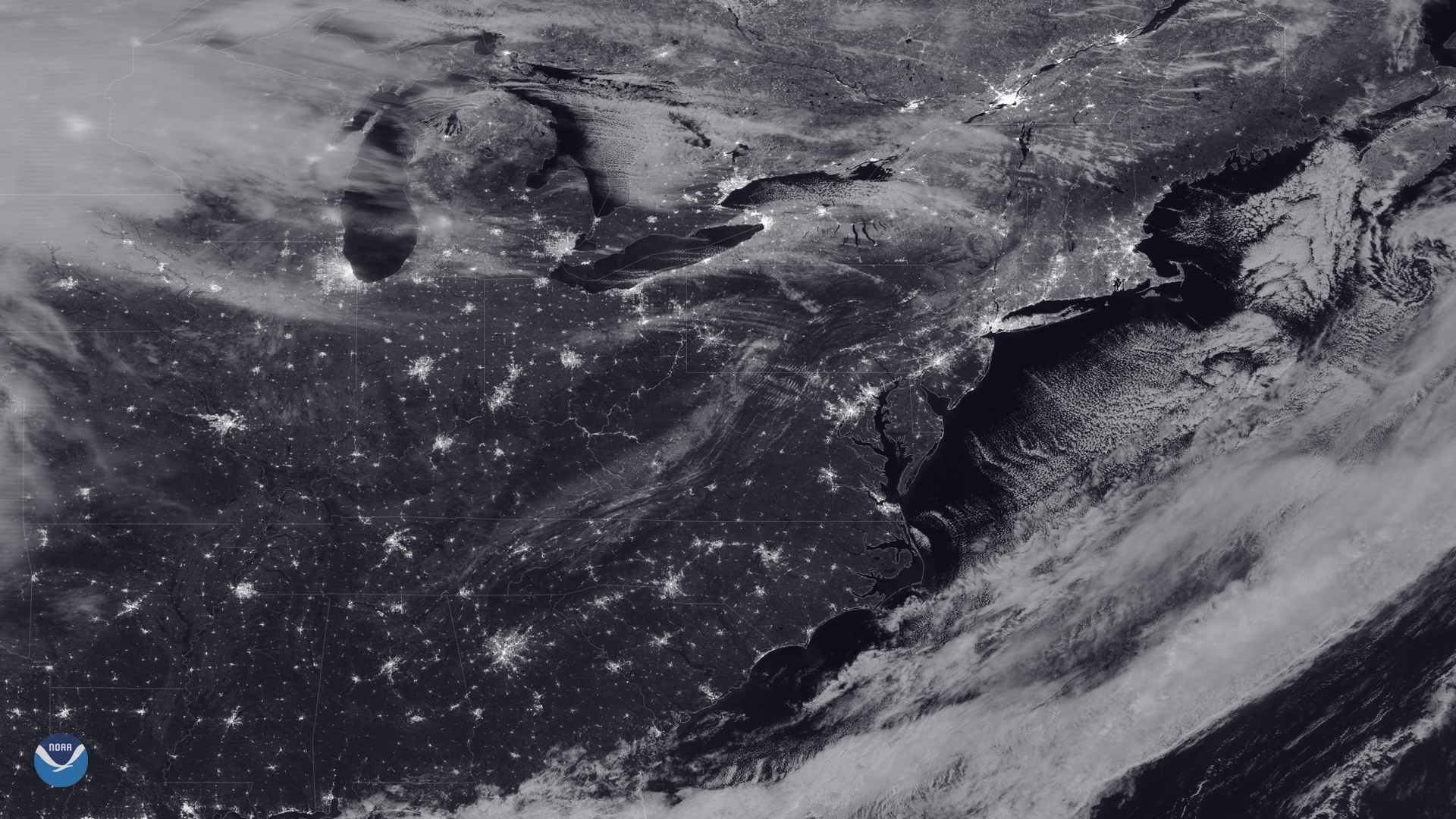
As the NOAA-20 satellite passed over the eastern United States on the night of the last full moon of the year, the sky was mostly crisp and clear while it took this beautiful day/night band snapshot at 2:15 a.m EST on Dec. 12, 2019.
Aside from the glittery lights of towns and cities, we can also see some snow on the ground in the northeast, along the Appalachian Mountains, and around the Great Lakes. Above these lakes, as well as off the coast of the Atlantic Ocean, cold air is moving over the relatively warmer water, picking up moisture as it goes. When this water vapor contacts the colder air above it and condenses, clouds form and then sink back down on either side. This process creates long parallel rows of rotating air called cloud streets , which are particularly visible over Lake Huron and off the coasts of New York, New Jersey, and Maryland in the image.
Above western Maryland and southern Pennsylvania, you can see wave clouds , which are also known as gravity waves. These often form when stable air moves over hills or mountains. Changes in air density causes it to oscillate, creating a ripple-effect in the clouds. Clouds can also form at the cooled crests of these waves when enough moisture is present in the atmosphere.
This image was captured by the NOAA-20 satellite's VIIRS instrument , which scans the entire Earth twice per day at a 750-meter resolution. Multiple visible and infrared channels allow it to detect atmospheric aerosols, such as dust, smoke and haze associated with industrial pollution and fires. The polar-orbiting satellite circles the globe 14 times daily and captures a complete daytime view of our planet once every 24 hours.
Where this page came from
This page was imported from NOAA Satellites (NESDIS). Published by NOAA's National Environmental Satellite, Data, and Information Service and, as a work of the United States government, in the public domain; pictures credited elsewhere are left out.
Nobody has written it yet — it is the source material at a new address, which is why search engines are asked to skip it and why no one earns from it. It is up for grabs: take it on, and it is yours to rewrite and to earn from.
Лицензия: CC0 1.0 (общественное достояние) · По материалам www.nesdis.noaa.gov
1
0
0
0

Комментарии