Есть что улучшить? Предложите правку.

Download Image Download Image of the Tropical Storms
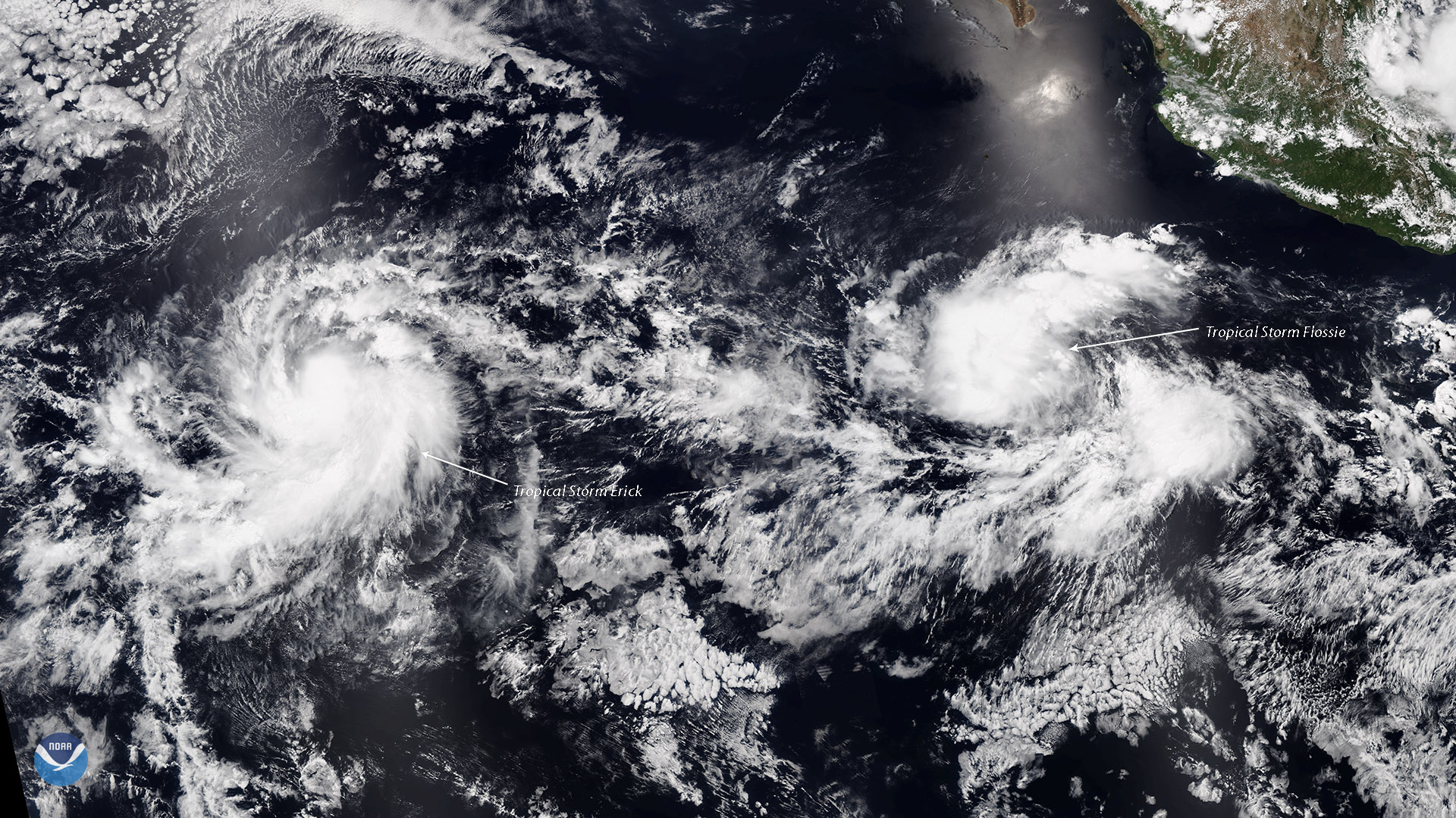
Tropical Storms Erick and Flossie, seen together in this July 28, 2019 view from the NOAA-20 satellite, are strengthening in the Eastern Pacific, according to the National Hurricane Center.
As of 11 a.m. ET, Erick had maximum sustained winds of 70 mph and was moving west at 17 mph. Microwave imagery indicated that Erick had developed an eye in the past several hours. Flossie had maximum sustained winds of 50 mph and was moving west at 18 mph.
The NHC predicts Tropical Storm Erick will continue tracking west toward Hawaii, attaining hurricane status today and potentially becoming a Category 3 hurricane within the next 2 days.
The NHC expects Flossie to gradually strengthen, becoming a hurricane on Tuesday.
This image was captured by NOAA-20's VIIRS instrument , which scans the entire Earth twice per day at a 750-meter resolution. Multiple visible and infrared channels allow us to obtain high-resolution satellite imagery of clouds, storms and atmospheric aerosols.
Where this page came from
This page was imported from NOAA Satellites (NESDIS). Published by NOAA's National Environmental Satellite, Data, and Information Service and, as a work of the United States government, in the public domain; pictures credited elsewhere are left out.
Nobody has written it yet — it is the source material at a new address, which is why search engines are asked to skip it and why no one earns from it. It is up for grabs: take it on, and it is yours to rewrite and to earn from.
Лицензия: CC0 1.0 (общественное достояние) · По материалам www.nesdis.noaa.gov
1
0
0
0

Комментарии