Есть что улучшить? Предложите правку.

Download Image Download Image of the Tropical Cyclone
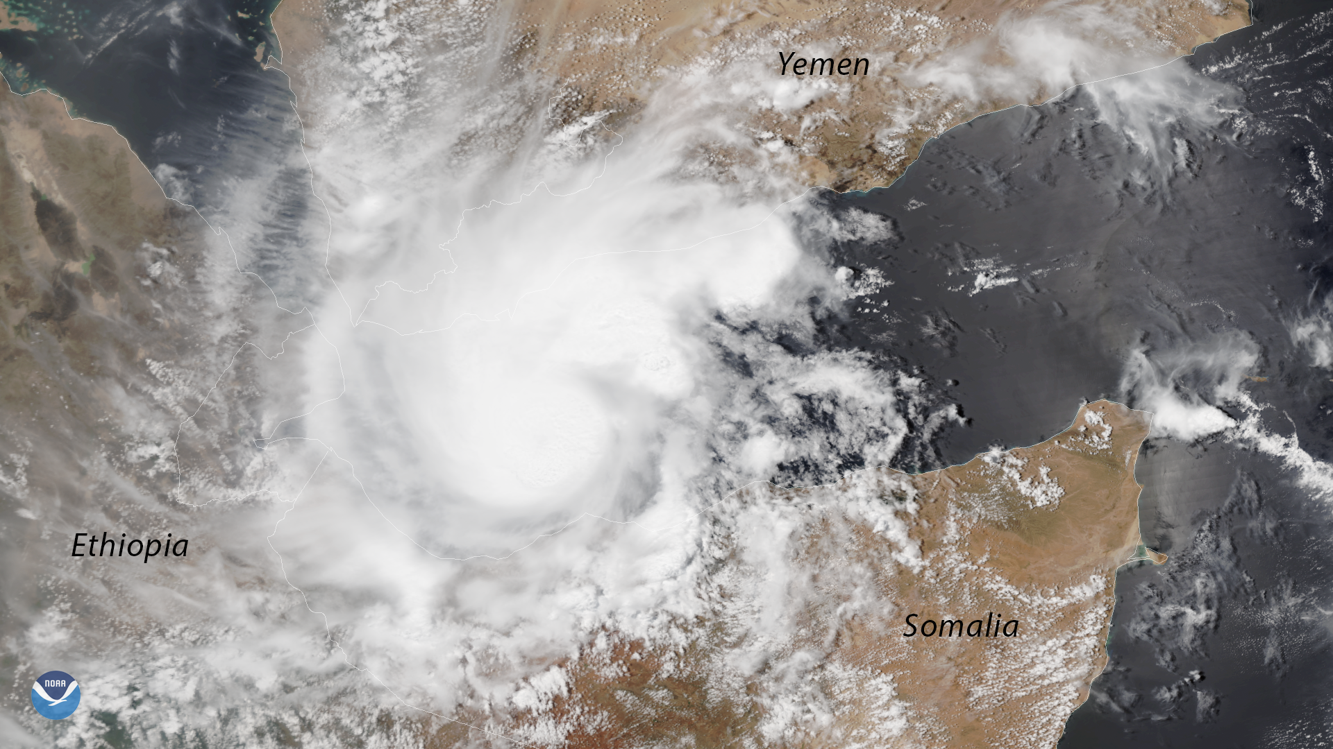
The NOAA-20 polar-orbiting satellite captured this image of a rare tropical cyclone in the Gulf of Aden, between Yemen and Somalia, on May 18, 2018. Named 'Sagar' by the Indian Meteorological Department on May 17, the storm is expected to deliver heavy rainfall and flash flooding across the southern Arabian Peninsula and the northern Horn of Africa, including Yemen, Somalia and Djibouti.
According to NOAA's historical hurricane tracks database , Sagar is only the third tropical storm seen in the Gulf of Aden since satellites began tracking storms from space in 1966. While tropical storms are common in the Arabian Sea, they rarely enter the Gulf of Aden, where the presence of dry, desert air typically tears these storms apart. The latest weather forecasts show the storm tracking toward western Somalia, with several inches of rain possible as far west as Djibouti.
The NOAA-20 satellite's VIIRS sensor provides global coverage twice a day with 750-meter resolution across its entire scan. Its daily multi-band imaging capabilities support the acquisition of high-resolution atmospheric imagery, including visible and infrared imaging of high-impact weather events, including hurricanes and tropical storms.
Where this page came from
This page was imported from NOAA Satellites (NESDIS). Published by NOAA's National Environmental Satellite, Data, and Information Service and, as a work of the United States government, in the public domain; pictures credited elsewhere are left out.
Nobody has written it yet — it is the source material at a new address, which is why search engines are asked to skip it and why no one earns from it. It is up for grabs: take it on, and it is yours to rewrite and to earn from.
Лицензия: CC0 1.0 (общественное достояние) · По материалам www.nesdis.noaa.gov
1
0
0
0

Комментарии