Есть что улучшить? Предложите правку.

Download Image Download Image of the Antarctic Cold Front
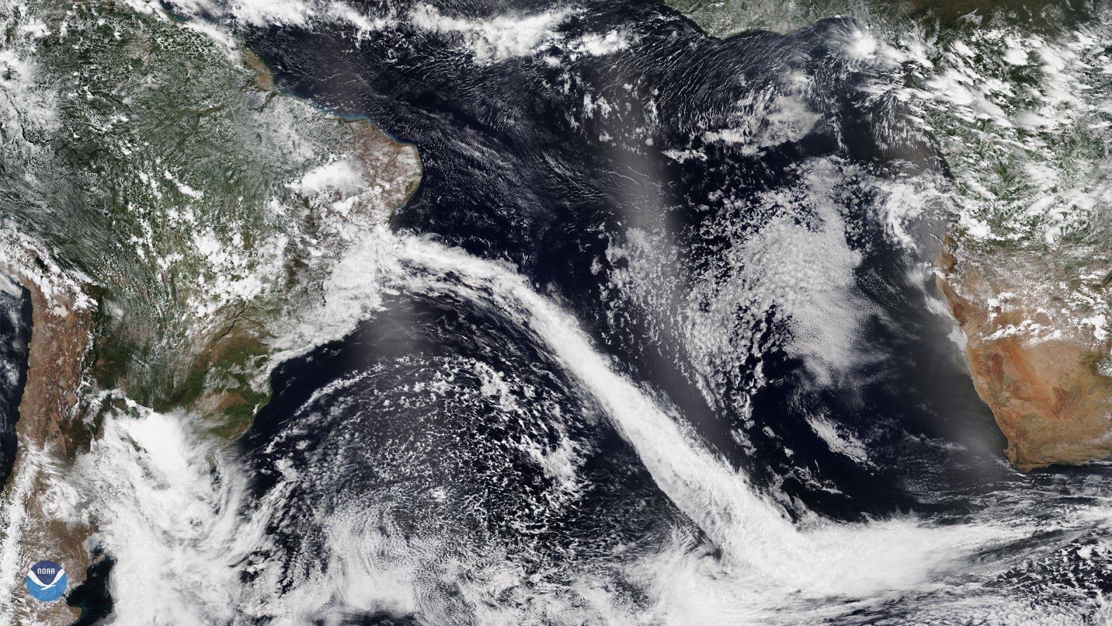
On Nov. 25, NOAA-20 captured this image of the Atlantic coastline of Brazil, which is currently experiencing a sharp cold front originating from Antarctica. A mid-latitude cyclone is blowing its way up the southeastern quadrant of South America, pushing warmer temperatures and humidity past Rio de Janeiro, while farther up north, Salvadore de Bahia, is currently experiencing heavy rain and thunderstorms.
Usually, Salvadore de Bahia’s weather patterns stay consistent within a few degrees Fahrenheit throughout the year, with its rainy season ending by early July. However, the recent weather is occurring outside of the normal precipitation patterns for the area, which is usually 3.9 inches during the month of November. The Instituto Nacional de Meteorologia (INMET) stated in their Technical Notes that the increased variance in precipitation is part of a larger long-term weather pattern. In the previous month, October, the average rainfall was 3.5 inches, which corresponds to 95% of the climatological average of 1981–2010 of 4 inches. Additionally, October 2019 was the fifth wettest on record, falling behind 6.3 inches from 2006.
Twelve hundred miles to the south, Rio de Janeiro is experiencing more drastic variations in precipitation patterns than the more tropical northern territory of Salvadore de Bahia; earlier this year, the city suffered catastrophic flooding due to elevated precipitation levels, raising concerns about the government’s ability to contend with increasingly extreme weather patterns.
This image was captured by the NOAA-20 satellite's VIIRS instrument, which scans the entire Earth twice per day at a 750-meter resolution. Multiple visible and infrared channels allow it to detect atmospheric aerosols, such as dust, smoke, and haze associated with industrial pollution and fires.
Where this page came from
This page was imported from NOAA Satellites (NESDIS). Published by NOAA's National Environmental Satellite, Data, and Information Service and, as a work of the United States government, in the public domain; pictures credited elsewhere are left out.
Nobody has written it yet — it is the source material at a new address, which is why search engines are asked to skip it and why no one earns from it. It is up for grabs: take it on, and it is yours to rewrite and to earn from.
Лицензия: CC0 1.0 (общественное достояние) · По материалам www.nesdis.noaa.gov
1
0
0
0

Комментарии