Есть что улучшить? Предложите правку.

Download Image Download Image of the Smoke from Australian Wildfires
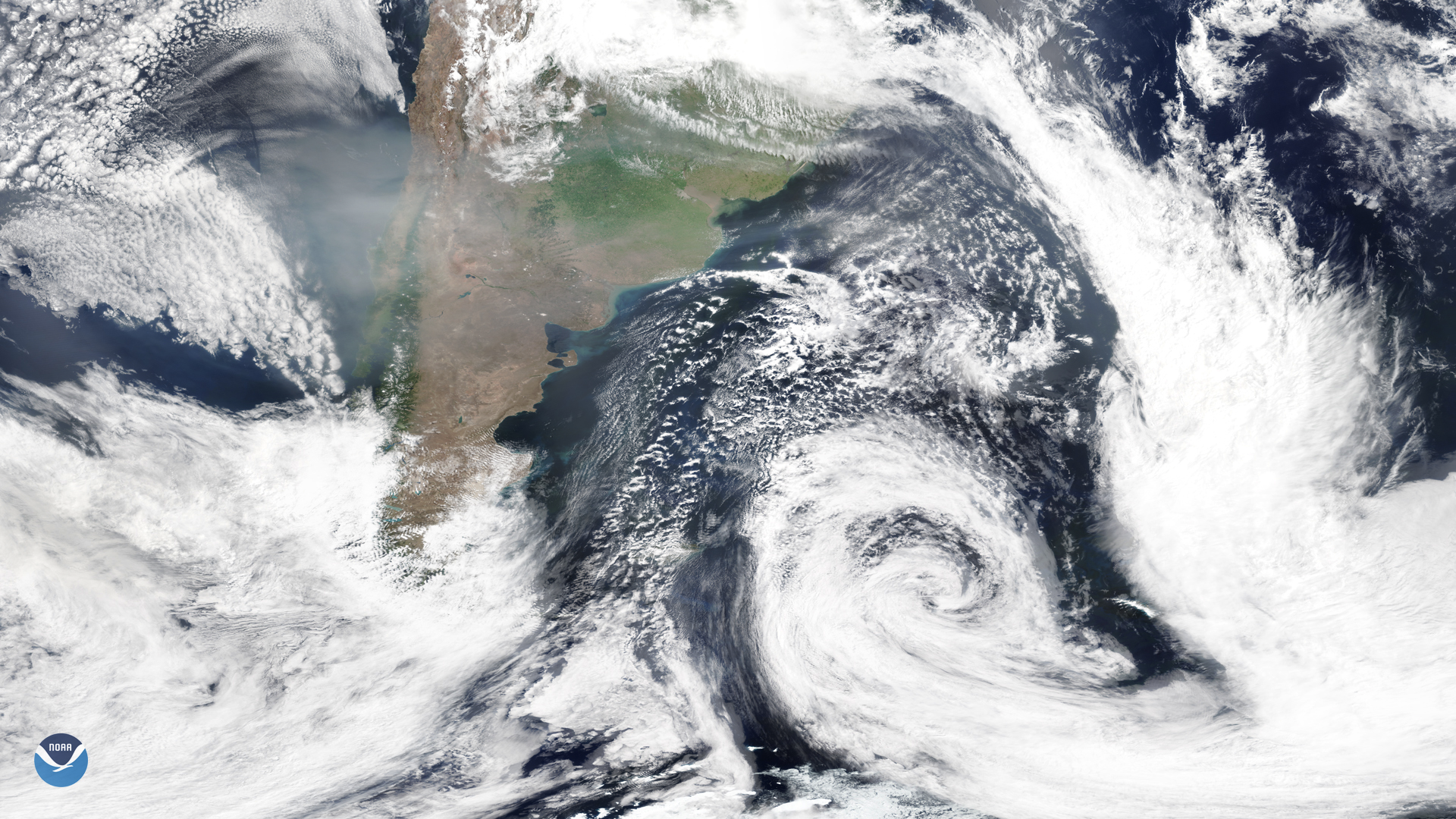
On Jan. 16, 2020, the NOAA-20 satellite snapped this image of the southern tip of South America, where smoke from the Australian bushfires is continuing to stream over the region in the form of a grayish haze. Some of the smoke is also being pulled into a strong area of low pressure off the eastern coast as it swirls eastward, moving away from the mainland.
Luckily, a few of the areas in southeastern Australia that have been suffering the most from the fires are finally seeing some relief, as recent thunderstorms have brought heavy rainfall to the states of New South Wales (NSW) and Victoria. The rain hasn’t been enough to completely extinguish the flames, though according to the NSW Rural Fire Service, there were still 82 fires burning as of yesterday, with more than 30 still yet to be contained. “Our fingers are crossed that this rain] continues over the coming days,” they [stated in a tweet.
The thunderstorms however, have caused some major power outages across NSW in addition to about 10,000 lightning strikes. Emergency crews are working to restore power safely.
Although more rain is predicted over the next few days, forecasters are warning that it may cause flash flooding, especially in areas of extremely parched land. In some places, the ground is so dry that water just runs across it, where vegetation that would normally soak up the water has been destroyed.
This image was captured by the NOAA-20 satellite's VIIRS instrument , which scans the entire Earth twice per day at a 750-meter resolution. Multiple visible and infrared channels allow it to detect atmospheric aerosols, such as dust, smoke and haze associated with industrial pollution and fires. The polar-orbiting satellite circles the globe 14 times daily and captures a complete daytime view of our planet once every 24 hours.
Where this page came from
This page was imported from NOAA Satellites (NESDIS). Published by NOAA's National Environmental Satellite, Data, and Information Service and, as a work of the United States government, in the public domain; pictures credited elsewhere are left out.
Nobody has written it yet — it is the source material at a new address, which is why search engines are asked to skip it and why no one earns from it. It is up for grabs: take it on, and it is yours to rewrite and to earn from.
Лицензия: CC0 1.0 (общественное достояние) · По материалам www.nesdis.noaa.gov
1
0
0
0

Комментарии