
Хотите улучшить содержимое страницы? Предложите правку.
The Battle of the Little Bighorn was fought over ground shaped by rock. The land at Little Bighorn Battlefield National Monument is mostly ridges cut by ravines and small stream beds known as coulees. During the battle, the ridges gave soldiers of the 7th Cavalry views across the broad valley and defensible high ground — while the ravines and coulees, cutting into the ridges like trenches, let the Native American tribes advance under cover.
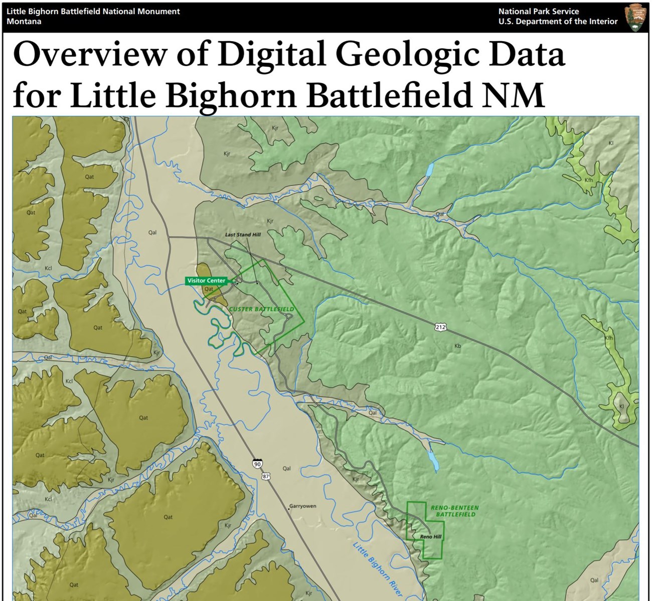
Part of the geologic map of the monument. Credit: National Park Service, Geologic Resources Inventory.
The monument
| Location | southeastern Montana |
| Established | January 29, 1879, as a national cemetery — less than three years after the battle |
| Renamed a national monument | December 10, 1991 |
| Area | 765 acres of federal land |
The monument memorializes one of the last major victories of the Northern Plains peoples in defending their ancestral way of life, and protects the place where Lieutenant Colonel George A. Custer and all the men under his immediate command died, on what is now Last Stand Hill. Its purpose is to preserve the battle's historic and natural resources and to teach visitors about the events around it and what followed.
The rocks
| Layer | Age | What it is |
|---|---|---|
| Bedrock | Late Cretaceous, about 100 to 66 million years ago | mostly shale and sandstone, from sediment laid down in the Cretaceous Interior Seaway, a shallow sea that covered west-central North America |
| Terrace deposits | Pleistocene, 2.6 million to 11,700 years ago | sediment left on terraces |
| Alluvium | Holocene, the last 11,700 years | loose gravel, sand, silt and clay laid down by rivers |
These rocks and deposits made the landforms that, in the end, influenced how the battle unfolded and how it ended.
Where the detail lives
The NPS Geodiversity Atlas describes the full variety of a park's geology and soils — rocks, minerals, sediments, fossils, landforms and the processes that shape them — to support education, geoconservation and management of living and non-living resources together. It draws on the Geologic Resources Inventory, which produces digital geologic maps and reports for more than 270 natural resource parks; its products for Little Bighorn are in the NPS DataStore.
Sources
Based on "NPS Geodiversity Atlas—Little Bighorn Battlefield National Monument, Montana," National Park Service, a work of the United States government in the public domain. It cites KellerLynn (2011) and Anderson (2017).
В подборкахLittle Bighorn Battlefield National Monument
Лицензия: CC0 1.0 (общественное достояние) · По материалам www.nps.gov
1
0
0
0

Комментарии


