
Хотите улучшить содержимое страницы? Предложите правку.
The Charlestown Navy Yard, also called the Boston Naval Shipyard, served the U.S. Navy for 174 years before closing in 1974. At its height it covered about 130 acres of the Charlestown, Massachusetts, waterfront just north of Boston. What to do with it was a puzzle: how to keep its history, make room for the public, and let the city grow.
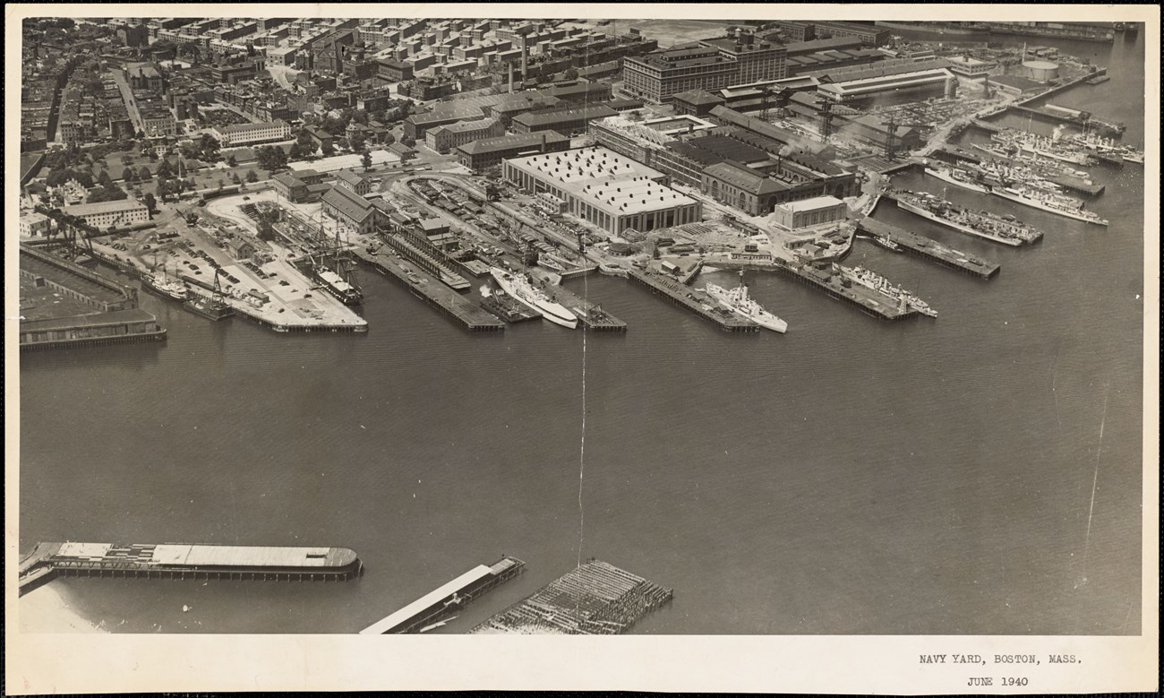
The Charlestown Navy Yard from the air, June 1940. National Archives at Boston.
Four areas, three goals
In 1978, federal and local officials divided the former yard into four areas to meet three goals: preserve its history, reserve space for an urban park, and open it to commercial development.
- The National Park Service received about 30 acres for Boston National Historical Park, created in 1974.
- About 100 acres went to the City of Boston, which split them into the Historic Monument Area, the Public Park Area and the New Development Area.
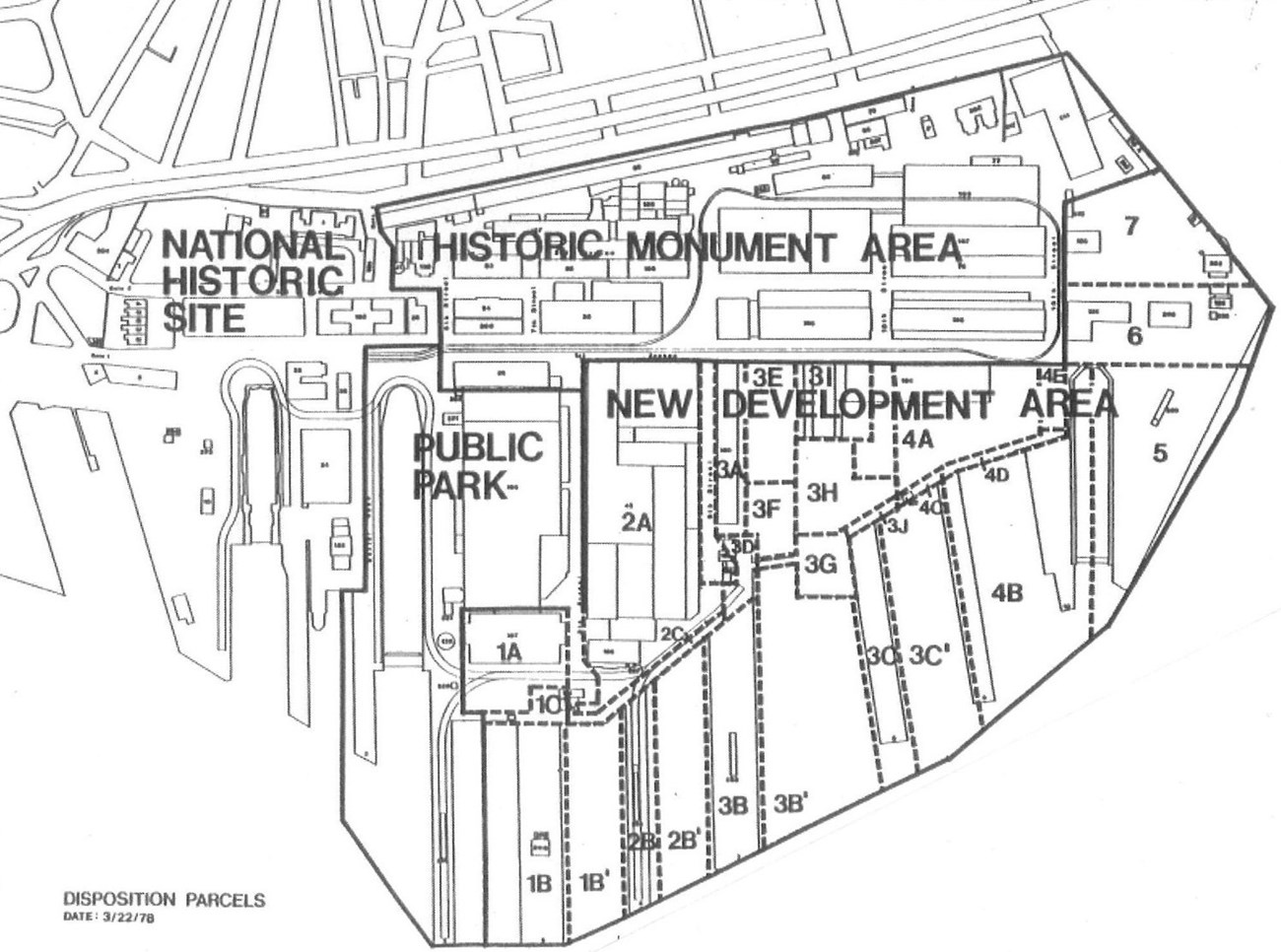
The four areas created from the former Navy Yard in 1978. From the Charlestown Navy Yard Historic Resource Study, 2010.
| Area | Size | Purpose |
|---|---|---|
| National Park Service | about 30 acres | the yard’s early-1800s core |
| Historic Monument Area | 30 acres | preserve industrial history |
| Public Park Area | about 16 acres | an urban park |
| New Development Area | about 58 acres | new development, with fewer preservation limits |
Saved: the Historic Monument Area
The Historic Monument Area (HMA) covers the northern central part of the yard, north of First Avenue, and preserves its industrial history through about 20 buildings, among them the Ropewalk and the Chain Forge. The City of Boston owns most of it. Private companies can take long-term leases on its buildings if they pledge to preserve the exteriors; inside, they may renovate as they need.
Three buildings came with special conditions. Developers of the Ropewalk and Chain Forge were encouraged to include historical exhibition space guided by the National Park Service, and Building 107 became an NPS operations building — and is set to become the new headquarters of the National Parks of Boston.
Open: the park and the development zone
The Public Park Area, also called the Recreation Area, covers Piers 3 and 4 and Dry Dock 2, and now holds Shipyard Park and the Korean War Memorial; the Charlestown Ferry leaves from the end of Pier 4. The New Development Area, the largest of the four, takes in Piers 5 to 11 and buildings in the yard’s southeastern quarter.
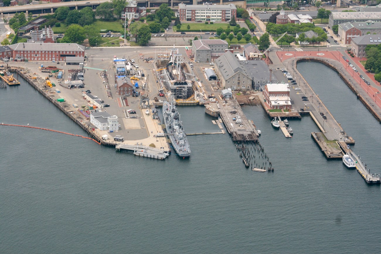
The Charlestown Navy Yard in Boston National Historical Park. NPS photo / T. Zion.
Historic: the national park
The Park Service’s section preserves the yard’s early-1800s origins and its old administrative and ceremonial heart: the Commandant’s House, the Marine Barracks, Piers 1 and 2 and Dry Dock 1.
Since 1978 the four areas have developed largely as planned, though work remains.
Sources
Based on "Charlestown Navy Yard: Historic Monument Area," National Park Service, drawing on Stephen P. Carlson’s Charlestown Navy Yard Historic Resource Study (2010) and other NPS and City of Boston sources; a work of the United States government in the public domain. The source says fifty years have passed since 1978, which does not fit its own date, so no span is given.
В подборкахBoston National Historical Park
Лицензия: CC0 1.0 (общественное достояние) · По материалам www.nps.gov
1
0
0
0

Комментарии


