Ser du något att förbättra? Föreslå en ändring.

Download Image Download Equinox Image
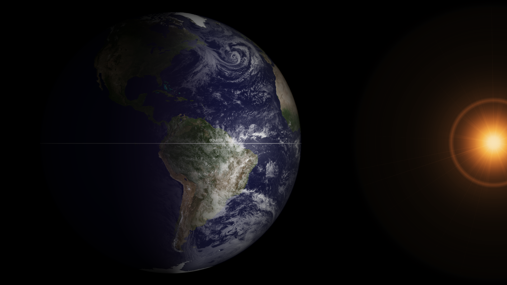
It is that time of year again (it happens twice) when the relative angle of Earth is perpendicular to the Sun, causing equal incoming solar energy to the Northern and Southern hemispheres - as well as roughly equal day and nighttime. At 7:02 ET on March 20, 2013, Earth was at its equinox. At 7:45 ET, the GOES-13 satellite captured this full disk image of Earth. The visible imagery sensor on GOES requires sunlight to “see” clouds, and so it provides a useful example of the equinox.
In this image the GOES imagery extends to each of the poles since the entire hemisphere is equally lit. After the equinox passes today, the Northern Hemisphere will be more lit than the Southern Hemisphere. The seasons are due to Earth's tilt on its axis, which causes changes in the amount of daylight and solar energy reaching each hemisphere throughout the year. (Note: the Sun in this image is artificially created, though the GOES spacecraft does have sensors continually monitoring the Sun for solar activity.)
Where this page came from
This page was imported from NOAA Satellites (NESDIS). Published by NOAA's National Environmental Satellite, Data, and Information Service and, as a work of the United States government, in the public domain; pictures credited elsewhere are left out.
Nobody has written it yet — it is the source material at a new address, which is why search engines are asked to skip it and why no one earns from it. It is up for grabs: take it on, and it is yours to rewrite and to earn from.
Licens: CC0 1.0 (allmän egendom) · Bearbetat efter www.nesdis.noaa.gov
1
0
0
0

Kommentarer