Ser du något att förbättra? Föreslå en ändring.

Download Image Download Indonesia Satellite Image
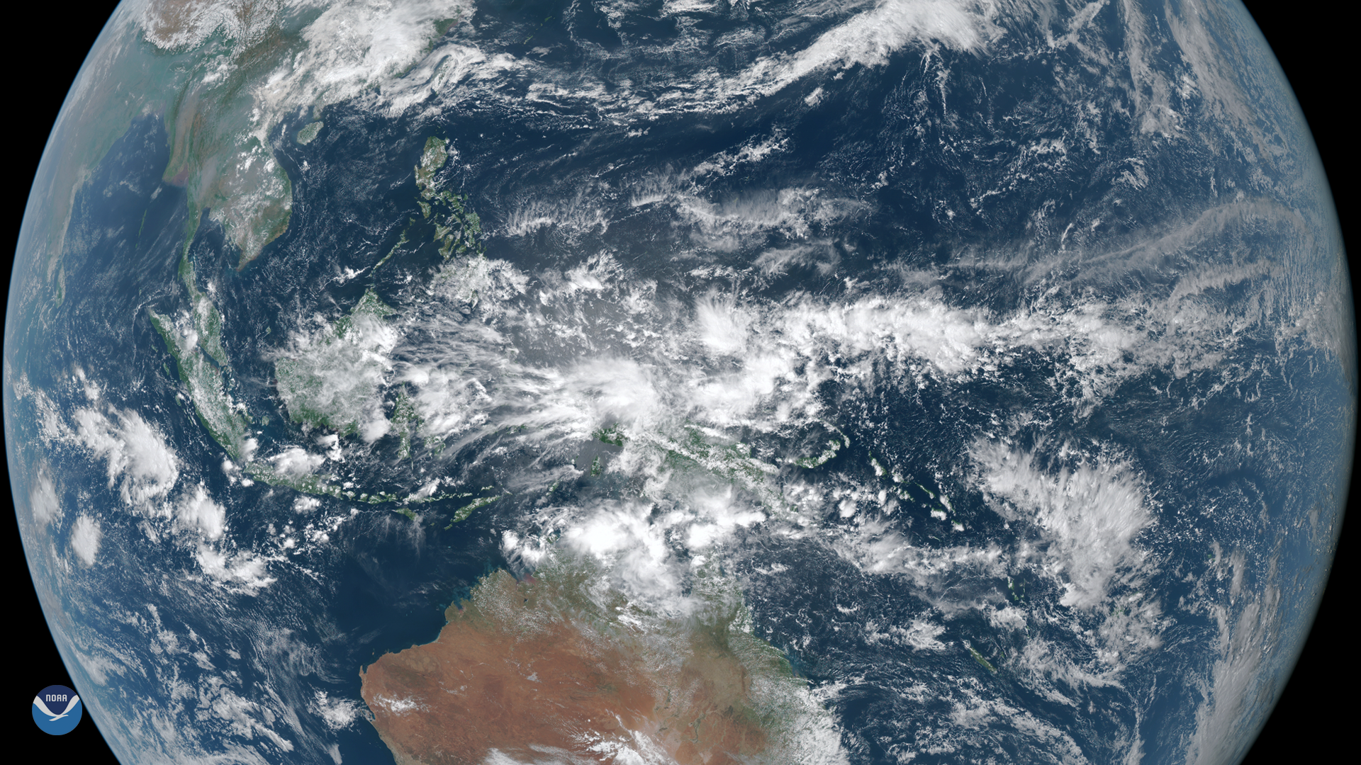
On March 23, 2020, the Himawari-8 satellite spied dense clouds producing heavy rain over Indonesia. Located between the Indian and Pacific Oceans, the world’s largest island nation generally has a hot, humid tropical climate with two seasons; the dry season and the monsoon season.
A monsoon (from the Arabic mawsim, which means "season") is a prevailing wind that arises due to a difference in temperatures between a landmass and the adjacent ocean that reverses its direction seasonally, according to the National Weather Service. It is often associated with heavy rains.
In Indonesia, the monsoon season generally lasts from November through March, while the dry season lasts from April through October. However, temperatures vary little from season to season due to its low latitude and the uniformly warm waters around the country’s many islands. If monsoons occur outside of the typical season, they usually blow in from the south and east; while from December through March, they tend to move in from the northwest.
In a 2019 multi-agency report on the state of global climate, flooding during monsoon season was one of the high-impact events highlighted that appeared to be affected by climate change. Another study mentioned that monsoon rainfall is greatly influenced by a number of weather systems and is incredibly complex. One thing is for certain: it is imperative to continue researching these interactions so we can better understand current shifts in monsoon weather patterns.
This image was captured by the Advanced Himawari Imager (AHI) on Japan’s Himawari-8 satellite. This satellite, the first unit of the Japan Meteorological Agency's (JMA) third-generation of geostationary satellites, provides visible light and infrared images of the Asia-Pacific region. Himawari's data are vital for global geostationary coverage, which is why NOAA and JMA have agreed to mutual back-up arrangements for their geostationary systems.
Where this page came from
This page was imported from NOAA Satellites (NESDIS). Published by NOAA's National Environmental Satellite, Data, and Information Service and, as a work of the United States government, in the public domain; pictures credited elsewhere are left out.
Nobody has written it yet — it is the source material at a new address, which is why search engines are asked to skip it and why no one earns from it. It is up for grabs: take it on, and it is yours to rewrite and to earn from.
Licens: CC0 1.0 (allmän egendom) · Bearbetat efter www.nesdis.noaa.gov
1
0
0
0

Kommentarer