
Ser du något att förbättra? Föreslå en ändring.
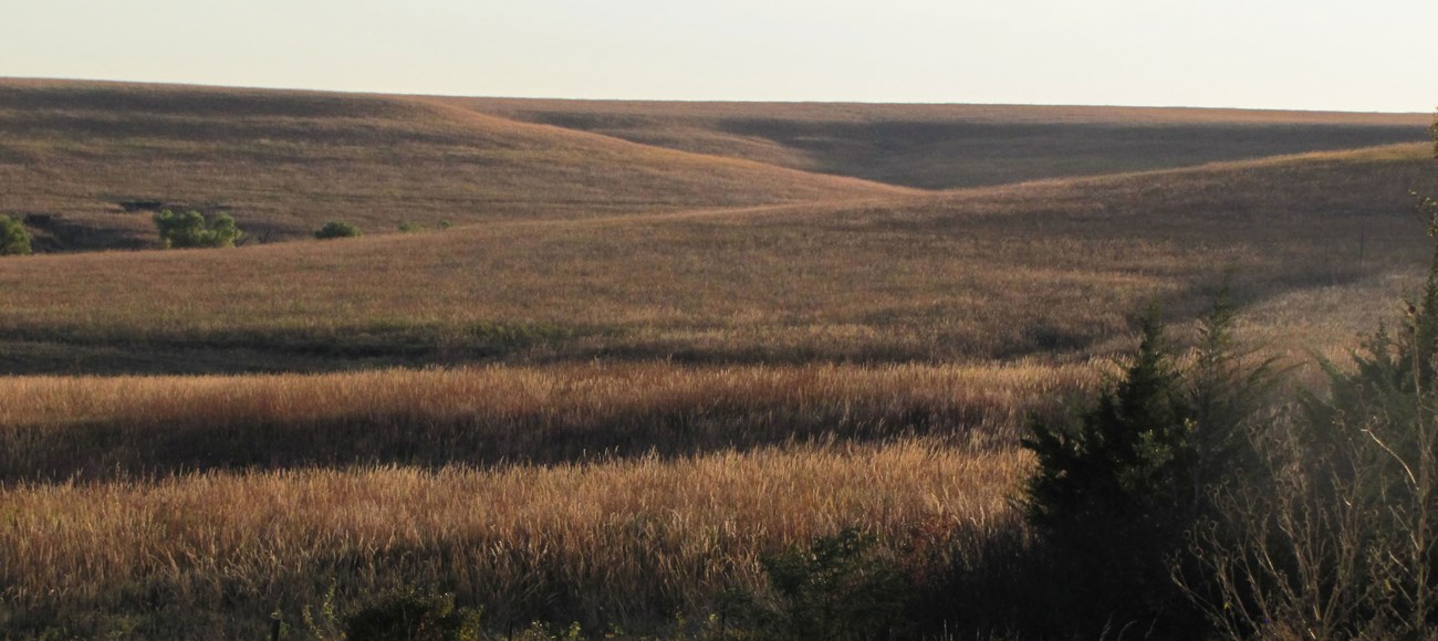
Tallgrass Prairie National Preserve lies just north of Strong City in Chase County, Kansas, about 105 km (65 miles) northeast of Wichita, in the Flint Hills. Established on November 12, 1996, it protects about 4,408 hectares (10,893 acres) of tallgrass prairie, along with the historic buildings of the Spring Hill Ranch.
Tallgrass prairie once spread across much of North America; today only an estimated four percent remains, lost to westward expansion and farming. The preserve holds a significant share of the pristine tallgrass prairie left in the United States, and tells how Native Americans and early settlers lived on and used the land. The Spring Hill Ranch Headquarters represents the Flint Hills' open-range cattle ranching legacy, with 19th-century buildings made of locally quarried limestone.

The rocks
The preserve sits in the Flint Hills Uplands — a raised, eroded plain underlain mostly by lower Permian limestones, shales (mudstones) and evaporites. The bedrock falls into two groups, oldest first:
| Group | Formations |
|---|---|
| Council Grove Group | Eskridge Shale, Beattie Limestone, Stearns Shale, Bader Limestone, Easly Creek Shale, Crouse Limestone, Blue Rapids Shale, Funston Limestone, Speiser Shale |
| Chase Group | Wreford Limestone, Matfield Shale, Barneston Limestone |
The tributary valleys of Fox Creek show some of the preserve's best exposed layers and some of its oldest bedrock. The youngest deposits are Neogene colluvium and alluvium along Fox Creek.
The preserve belongs to the Central Lowland physiographic province, sharing its geologic history and some characteristic formations with a much wider region.
Geodiversity
Geodiversity is the full range of a park's geologic and soil resources and processes — rocks, minerals, sediments, fossils, landforms and the forces that shape them. The Park Service's Geodiversity Atlas, from the Geologic Resources Inventory, supports education, geoconservation and managing living and non-living parts of ecosystems together.
Maps and data
The Geologic Resources Inventory produces digital geologic maps and reports for more than 270 natural resource parks — scoping summaries, GIS maps (newer ones also for Google Earth and online map services), reports on setting, features, management issues and history, and posters. The preserve's products are in the NPS DataStore (saved search 3178), along with its completed Soil Resources Inventory (saved search 3129).
More
- Tallgrass Prairie: nature and science · geology · building materials and stone tools · park home
- National Park Service: geologic time · regional geology
Sources
Based on "NPS Geodiversity Atlas—Tallgrass Prairie National Preserve, Kansas," National Park Service; a work of the United States government in the public domain. It cites Aber (1997) and National Park Service documents from 2016 and 2017.
I dessa publikationerTallgrass Prairie National Preserve
Licens: CC0 1.0 (allmän egendom) · Bearbetat efter www.nps.gov
1
0
0
0

Kommentarer


