
Vill du förbättra sidans innehåll? Föreslå en ändring.
The Snake River is the largest tributary of the Columbia River. It rises in western Wyoming, flows through Idaho and Oregon and joins the Columbia in Washington State; its basin also takes in parts of Utah and Nevada. Each year from spring to fall, the Park Service's Greater Yellowstone Inventory and Monitoring Network checks its water quality and flow at two sites: Flagg Ranch, Wyoming, above Jackson Lake, and Moose, Wyoming, below the lake's dam. Its verdict for 2023: water of high quality — with a much-reduced spring peak below the dam, and stretches of summer too warm for cold-water fish.
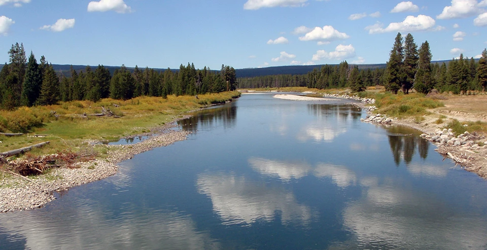
The Snake River at Flagg Ranch, Wyoming. NPS photo.
Two sites, one dam between them
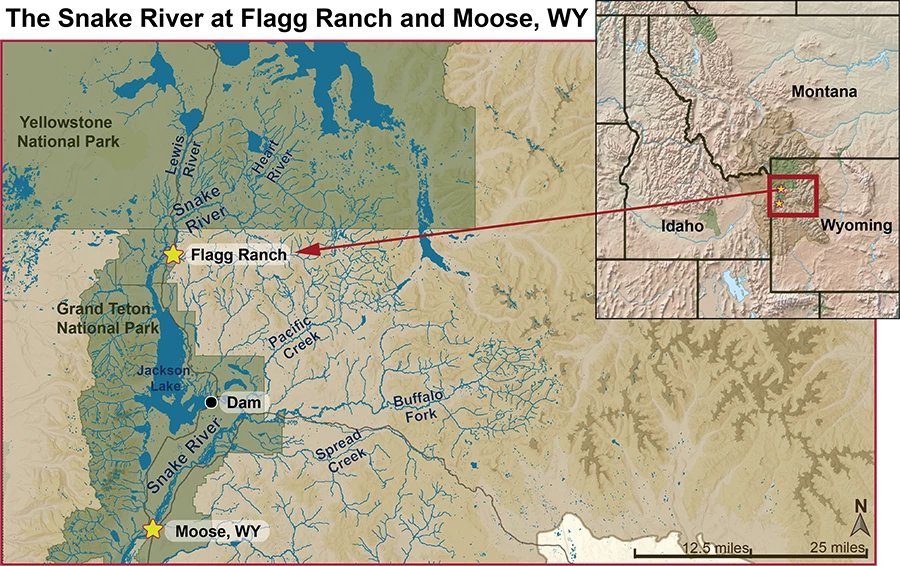
The watersheds, tributaries and Park Service lands around the two monitoring sites. NPS.
| Flagg Ranch (above Jackson Lake) | Moose (below Jackson Lake) | |
|---|---|---|
| Upstream | 486 mi² (1,259 km²) of drainage; 47 miles (76 km) from the source on the Two Ocean Plateau, through Yellowstone, Bridger-Teton National Forest and the John D. Rockefeller, Jr. Memorial Parkway | About 7 miles on to Jackson Lake; below the dam, Pacific Creek, Buffalo Fork and Spread Creek add significant water |
| Main tributaries | Heart River and Lewis River, both from lakes of the same names in Yellowstone | — |
| Land | All Park Service and Forest Service | All Park Service and Forest Service |
| USGS gage | 13010065, daily flows since October 1983 | 13013650, daily flows since 1995 |
The Jackson Lake Dam dominates the river for about 4.5 miles, until Pacific Creek joins. Just below the dam, operations can cut the peak flow to half the estimated unregulated flow and delay the median date of maximum flow by more than three weeks — a significant effect on the river system.
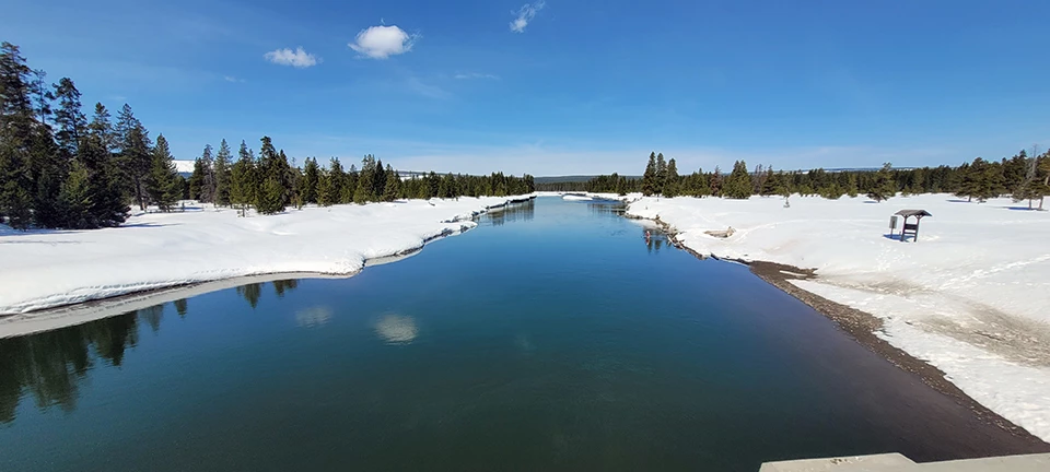
Looking downstream from the Flagg Ranch site, April 2023. NPS photo.
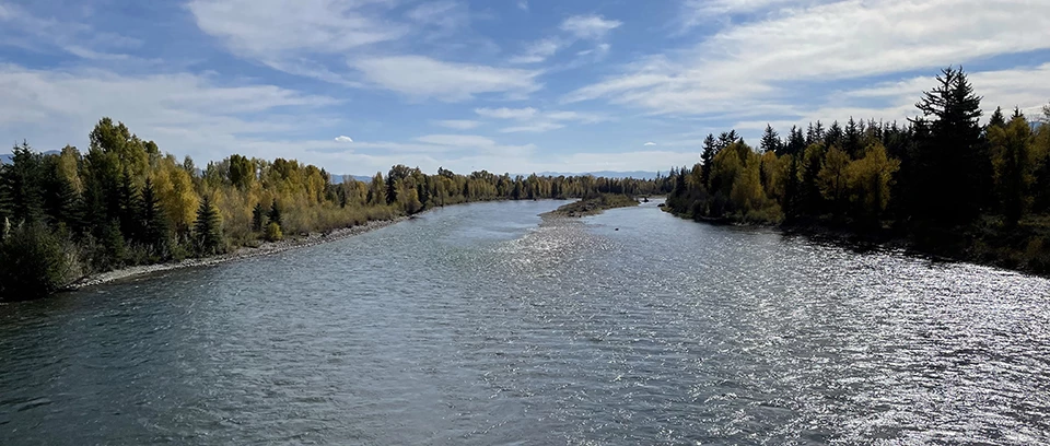
Looking downstream from the bridge at the Moose site, September 2023. NPS photo.
Flow in 2023
| Flagg Ranch | Moose | |
|---|---|---|
| Average annual peak | 6,570 cfs on 26 May (1984–2022) | 12,165 cfs on 6 June (1995–2022) |
| 2023 peak | 6,260 cfs on 24 May — in line with the average | 6,980 cfs on 25 May — just over half the average |
| Low flow | 231 cfs in 2023 (average minimum 232 cfs), lowest in January and February | 662 cfs, lowest mostly in late March and early April |
At Flagg Ranch, the river followed the usual pattern of snowmelt-fed rivers in the Northern Rockies: high in early summer, low base flows in late summer and fall. At Moose, summer flows ran well below average and only rejoined the historical pattern in early August.
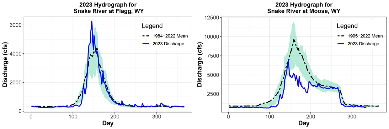
2023 flow (blue) against the period-of-record average (dashed) at Flagg Ranch (left) and Moose (right); the shaded band is the normal range. NPS.
Water quality
Both sites were sampled in eight months of the year — February through November, except March and July — for temperature, specific conductance, dissolved oxygen, pH and turbidity, plus water chemistry.
- Temperature. Daily maximums passed Wyoming's 20°C (68°F) guidance for cold-water fish on 40 days in July and August at Flagg Ranch, and on 10 days in late July and mid-August at Moose.
- Nutrients. Low levels of dissolved and total nutrients, comparable to past years.
- Metals. Arsenic, copper and iron occur naturally in the watershed and rise and fall with runoff. Iron and phosphorus peaked with peak flows, and total iron exceeded Wyoming's chronic aquatic-life criterion of 1 mg/L in May at both sites.
- A caution. Some 2023 blank samples picked up trace total phosphorus, so those values should be read with care.
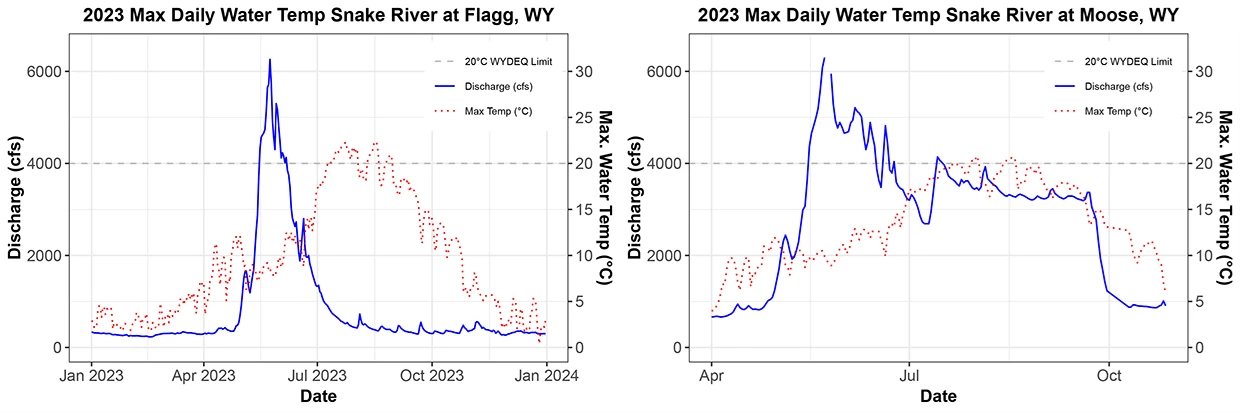
Daily flow and maximum water temperature at Flagg Ranch (left) and Moose (right); the dashed line is Wyoming's 20°C criterion. NPS.
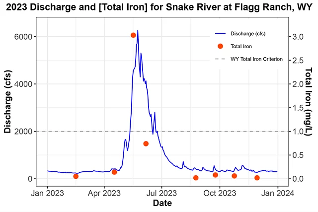
Total iron at Flagg Ranch in 2023, against the 1.0 mg/L criterion. NPS.
How it's measured, and how it's protected
Crews sample monthly in ice-free months, following the USGS National Field Manual. From a bridge, a crane and reel lower a DS-95 sampler; in shallow, slow water, a hand-held 1-liter DH-81 sampler on a 1-meter wading rod does the job. Water from several points across the river goes into an 8-liter churn splitter, and subsamples go overnight to an EPA-certified lab, Energy Laboratories in Billings, Montana. Results are public on the Water Quality Portal (site IDs 11NPSWRD_WQX-GRTE_SNR01 and SNR02).
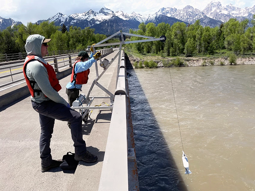
A Scientists in Parks intern lowers the DS-95 sampler from the bridge at Moose in June 2023 while a Montana State University intern watches upstream for boats and debris. NPS / Jana Cram.
Wyoming designates the upper Snake as Outstanding (Class 1) water: it is known to support fish or supply drinking water, and no further degradation from point sources other than dams is allowed. Every reach is also managed under the Snake River Headwaters Comprehensive River Management Plan, as directed by the Craig Thomas Snake Headwaters Legacy Act of 2008, a 2009 amendment to the 1968 Wild and Scenic Rivers Act. Results are compared with EPA and Wyoming water quality standards.
Sources
Based on Cram, J., A. Volk, B. LaFrance and T. Hubbard, 2024, "Water Resources Monitoring in the Snake River Above and Below Jackson Lake, 2023," Greater Yellowstone Network, National Park Service; a work of the United States government in the public domain.
I dessa samlingarGrand Teton National Park
Licens: CC0 1.0 (allmän egendom) · Bearbetat efter www.nps.gov
1
0
0
0

Kommentarer
Läs härnäst


