Ser du något att förbättra? Föreslå en ändring.

Download Image Download Image of Tropical Cyclone Gita
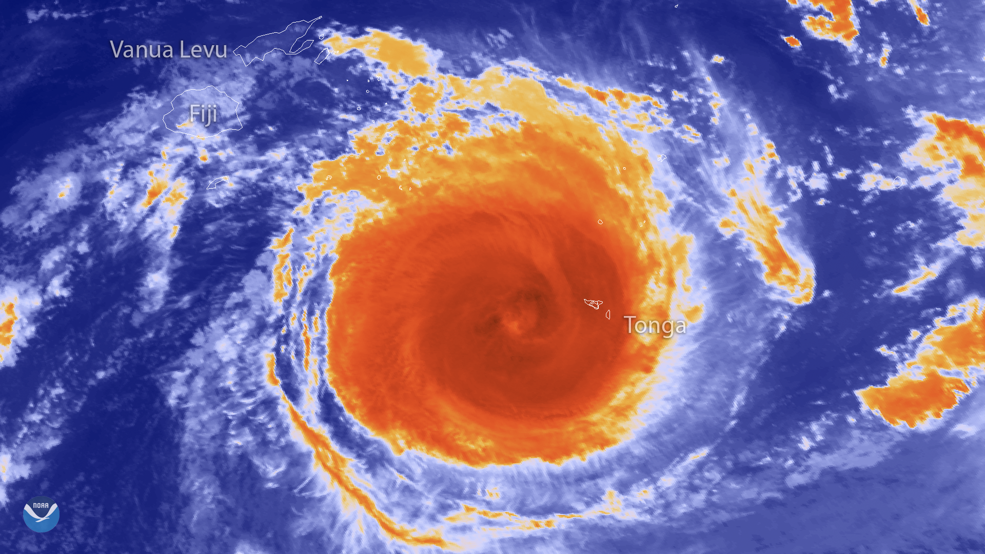
The Japan Meteorological Agency's Himawari-8 satellite captured this thermal infrared imagery of powerful Tropical Cyclone Gita in the South Pacific at 1550 UTC on February 12, 2018. The latest report from the Joint Typhoon Warning Center said the storm had sustained winds near 145 mph as it tracked westward past the island nation of Tonga. The storm's eyewall raked across Tonga's capital, Nuku'alofa, Monday evening (local time), battering the city with destructive winds and flooding rain.
Though located in the tropics, Tonga does not typically see storms of this magnitude. NOAA's historical database of hurricane and tropical cyclone tracks shows only one other storm Category 4 or stronger (Cyclone Ian in 2014) has ever passed within 200 miles of the island. Gita is therefore the strongest storm on record to strike the Polynesian kingdom.
This imagery is generated from the Himawari-8 satellite's channel 13 infrared band. Infrared images like this one can help meteorologists identify important features of severe storms. Areas with the most intense convection (dark orange) surround the eye of the storm and indicate where the heaviest rainfall is occurring.
Where this page came from
This page was imported from NOAA Satellites (NESDIS). Published by NOAA's National Environmental Satellite, Data, and Information Service and, as a work of the United States government, in the public domain; pictures credited elsewhere are left out.
Nobody has written it yet — it is the source material at a new address, which is why search engines are asked to skip it and why no one earns from it. It is up for grabs: take it on, and it is yours to rewrite and to earn from.
Licens: CC0 1.0 (allmän egendom) · Bearbetat efter www.nesdis.noaa.gov
1
0
0
0

Kommentarer