
Most visitors to Lake Mead National Recreation Area come for the water: two reservoirs on the Colorado River offering about 751 km² (290 square miles) to boat, fish, swim, ski and sail on. The land around them holds something rarer — rocks spanning roughly two and a half billion years, and a record since the Cambrian with few gaps.
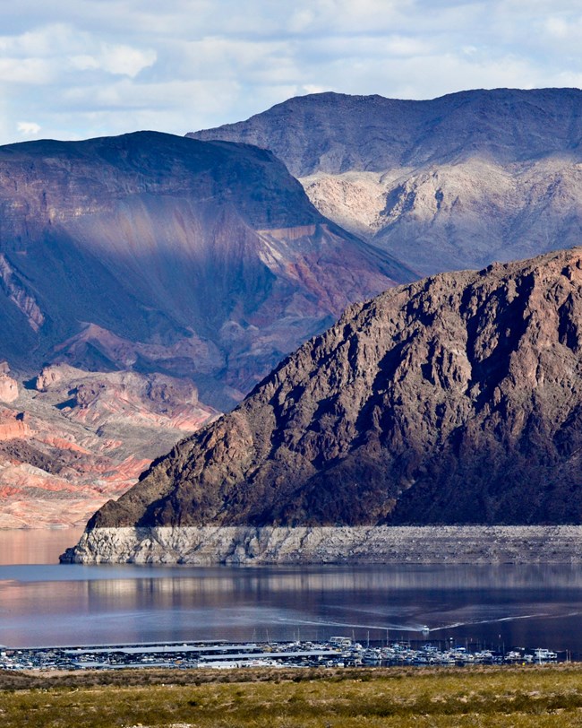
Boulder Basin.
A park of firsts and superlatives
Lake Mead is the first and largest national recreation area in America, in Clark County, Nevada, and Mohave County, Arizona. Lake Mead is held back by Hoover Dam and Lake Mohave by Davis Dam.
| Date | Milestone |
|---|---|
| October 13, 1936 | Established as Boulder Dam Recreation Area |
| 1947 | Renamed Lake Mead National Recreation Area |
| October 8, 1964 | Placed under the sole jurisdiction of the NPS after years of joint management with the Bureau of Reclamation |
It covers 605,331 hectares (1,495,806 acres) of mountains, canyons, valleys and the two lakes, and protects nine wilderness areas and 1,347 recorded archeological sites.
Where two provinces meet
The park sits on the boundary between the Basin and Range and the Colorado Plateau, a line marked by the Grand Wash Cliffs, which cross the easternmost part of the Lake Mead segment. Most of the park — both lakes included — is Basin and Range. The detached Arizona portion is on the Colorado Plateau and looks like the Grand Canyon.
| Place | Elevation |
|---|---|
| Spirit Mountain (Newberry Mountains) | 5,639 feet |
| Andrus Point, north of the Grand Canyon | 5,491 feet (over 5,600 feet farther north) |
| Muddy Peak, just outside the park | 5,432 feet |
| Lake Mead water surface, average 1939–2003 | 1,176 feet |
| Lake Mead water surface, average in 2003 | 1,143 feet |
| Lake Mohave water surface | below 800 feet |
The Black Mountains and Muddy Mountains rise in the north of the Nevada portion; to the south, the Colorado River and Lake Mohave run east of the Eldorado and Newberry mountains.
The record in the rocks
| Age | Rocks |
|---|---|
| 2.5 to 1.6 billion years (Paleoproterozoic) | Schist and gneiss — the oldest bedrock |
| 1.7 to about 1.4 billion years (late Paleoproterozoic–Mesoproterozoic) | Intrusive igneous bodies |
| Since the Cambrian (541 million years) | Paleozoic to lower Mesozoic sedimentary units, with few gaps |
| Neogene | Volcanic episodes that built the Hamblin–Cleopatra Volcano and the black lava-capped mesas such as Fortification Hill and Callville Mesa |
| Neogene–Quaternary | Younger sediments, to the Pleistocene |
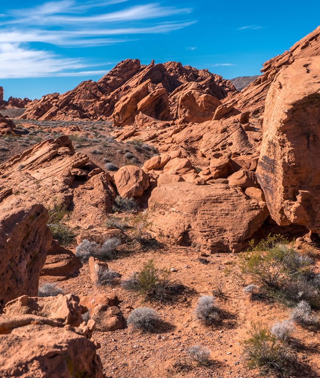
Redstone outcrops near Northshore Road.
What has been mapped
Lake Mead is covered by the NPS Geologic Resources Inventory, which produces scoping summaries, digital geologic maps, reports and posters for more than 270 natural resource parks. A Soil Resources Inventory has also been started. Both are in the NPS DataStore.
Sources
Based on "NPS Geodiversity Atlas—Lake Mead National Recreation Area, Nevada and Arizona," National Park Service, Geologic Resources Division, citing Bonde et al. (2018), Beard et al. (2007) and Anderson (2017); a work of the United States government in the public domain.
收录于这些合集Lake Mead National Recreation Area
许可协议: CC0 1.0(公有领域) · 改编自 www.nps.gov
1
0
0
0

留言


