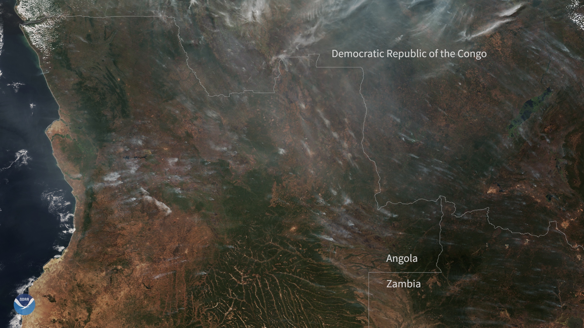
Download Image Download Image of Central Africa
On July 5, 2020, the NOAA-20 satellite captured this True Color imagery of hazy smoke from fires burning across a large portion of central Africa—particularly in Angola, the Democratic Republic of the Congo, and Zambia. These fires are most likely agricultural, set by farmers to clear land to make way for the new planting season as well as to help return nutrients to the soil.
Interestingly, a study published last year in Proceedings of the National Academy of Sciences (PNAS), found that smoke from fires in Africa may be the most important source of phosphorus, a fertilizer, in the Amazon rainforest as well as the tropical Atlantic and Southern oceans where it stimulates the productivity of marine phytoplankton. In the past, it was assumed that wind-blown Saharan dust was the main source of phosphorus for these ecosystems, though researchers stress more studies need to be done to verify the findings and learn more.
Despite this, these fires can also have some serious repercussions for the ecosystem and degrade air quality since certain chemicals released are hazardous to breathe. This is particularly a problem with “slash and burn” agriculture, which some farmers practice to completely clear areas with dense vegetation or forests.
According to the Global Forest Watch website, there have been 135,873 hotspots detected in these three countries alone by the VIIRS instrument’s thermal sensors aboard the NOAA-20 and Suomi-NPP satellites since July 1. Granted, “hotspots” are simply areas where a substantial amount of heat is detected and may not necessarily be a fire (as opposed to a hot asphalt road, etc.) but the occurrence of a false positive is relatively low.
This true-color image was captured by the VIIRS sensor onboard the NOAA-20 satellite, which provides daily, high-resolution visible and infrared images of Earth's atmosphere from across the globe.
Where this page came from
This page was imported from NOAA Satellites (NESDIS). Published by NOAA's National Environmental Satellite, Data, and Information Service and, as a work of the United States government, in the public domain; pictures credited elsewhere are left out.
Nobody has written it yet — it is the source material at a new address, which is why search engines are asked to skip it and why no one earns from it. It is up for grabs: take it on, and it is yours to rewrite and to earn from.
许可协议: CC0 1.0(公有领域) · 改编自 www.nesdis.noaa.gov
1
0
0
0

留言