
On This Page Navigation
Geodiversity refers to the full variety of natural geologic (rocks, minerals, sediments, fossils, landforms, and physical processes) and soil resources and processes that occur in the park. A product of the Geologic Resources Inventory, the NPS Geodiversity Atlas delivers information in support of education, Geoconservation, and integrated management of living (biotic) and non-living (abiotic) components of the ecosystem.
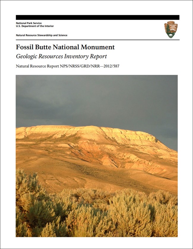
In-depth geologic information is contained in the baseline inventory products of the Geologic Resources Inventory, see table below.
Introduction
Fossil Butte National Monument (FOBU) is located along the eastern flank of the Wasatch Range in Lincoln County, southwestern Wyoming. FOBU was established October 23, 1972 and encompasses 3,318 hectares (8,198 acres) of flat-topped ridges that contain some of the world’s best-preserved fossils. Fossilized fishes, insects, plants, reptiles, birds, and mammals are exceptionally abundant and highly detailed; such rare preservation is called a Lagerstätte. At FOBU, the highly detailed preservation of soft organisms and delicate structures such as skin have allowed scientists to study and interpret entirely extinct ecosystems from 50 million years ago (Graham 2012).
Geologic Setting
The geology of FOBU records an Eocene environment at a time when Wyoming was part of a warm-temperate habitat that was home to palm trees, insects, paddlefish, stingrays, gar, pike, trout-perch, herring, turtles, snakes, lizards, crocodiles, parrots, bitterns, goatsuckers, oilbirds, and mammals (Graham 2012). New discoveries continue to shed light on an ecosystem that developed during a global greenhouse climate that was one of the warmest in the past 66 million years. Strata that contain the articulated fossil specimens of FOBU include the Green River Formation and Wasatch Formation, which represent lacustrine (lake), fluvial (river) and floodplain depositional environments favorable to burial and preservation. While the strata in FOBU are Eocene in age, rocks exposed in the mountain ranges that border Fossil Basin to the east and west span back to the Devonian (Graham 2012). FOBU includes two stratotype occurrences: the type sections of the Angelo and Fossil Butte Members of the Eocene Green River Formation.
Paleontological Resources
All NPS fossil resources are protected under the Paleontological Resources Preservation Act of 2009 (Public Law 111-11, Title VI, Subtitle D; 16 U.S.C. §§ 470aaa - 470aaa-11).
Abandoned Mineral Lands
NPS AML sites can be important cultural resources and habitat, but many pose risks to park visitors and wildlife, and degrade water quality, park landscapes, and physical and biological resources. Be safe near AML sites—Stay Out and Stay Alive!
Regional Geology
Fossil Butte National Monument is a part of the Middle Rocky Mountains Physiographic Province and shares its geologic history and some characteristic geologic formations with a region that extends well beyond park boundaries.
Maps and Reports

.
Geologic Resources Inventory
The Geologic Resources Inventory produces digital geologic maps and reports for more than 270 natural resource parks. The products listed below are currently available for this park, check back often for updates as many maps, reports, and posters are still in progress.
Scoping summaries are records of scoping meetings where NPS staff and local geologists determined the park’s geologic mapping plan and what content should be included in the report.
- Digital geologic maps include files for viewing in GIS software, a guide to using the data, and a document with ancillary map information. Newer products also include data viewable in Google Earth and online map services.
- Reports use the maps to discuss the park’s setting and significance, notable geologic features and processes, geologic resource management issues, and geologic history.
- Posters are a static view of the GIS data in PDF format. Newer posters include aerial imagery or shaded relief and other park information. They are also included with the reports.
- Projects list basic information about the program and all products available for a park.
Source: NPS DataStore Saved Search 2866. To search for additional information, visit the NPS DataStore.
Soil Resources inventory
A NPS Soil Resources Inventory project has been completed for Fossil Butte National Monument and can be found on the NPS Data Store.
Source: NPS DataStore Saved Search 2935. To search for additional information, visit the NPS DataStore.

The 50 million year old rocks of the Green River Formation are exposed on Cundick Ridge in Fossil Butte National Monument, Wyoming.
Related Links
Fossil Butte—World-Class Fossils
Fossil Butte—Geologic Formations
Wyoming State Geological Survey
Fossil Butte National Monument
Narrow By Location
Narrow By Office
Show
10
40
Sort by
Relevance
Recently Updated
Date Released
Title
Loading results...
Tags:
geodiversity
,
geologic
,
[geologic forces](/media/article-search.htm?q=geologic forces)
,
[geologic resources](/media/article-search.htm?q=geologic resources)
,
[geologic feature](/media/article-search.htm?q=geologic feature)
,
[geologic time](/media/article-search.htm?q=geologic time)
,
[geologic layers](/media/article-search.htm?q=geologic layers)
,
[geologic history](/media/article-search.htm?q=geologic history)
,
[geologic formations](/media/article-search.htm?q=geologic formations)
,
geology
,
geological
,
[geological maps](/media/article-search.htm?q=geological maps)
,
geologist
,
[geology talk](/media/article-search.htm?q=geology talk)
,
[geology hike](/media/article-search.htm?q=geology hike)
,
[geology science and learning](/media/article-search.htm?q=geology science and learning)
,
geologists
,
[geology close up](/media/article-search.htm?q=geology close up)
,
[geologic resources inventory](/media/article-search.htm?q=geologic resources inventory)
,
geoheritage
,
geohazards
,
geomorphology
,
[geoscientists in parks](/media/article-search.htm?q=Geoscientists in Parks)
,
geoscientists-in-the-parks
,
[geological survey](/media/article-search.htm?q=Geological Survey)
,
geothermal
,
[geothermal activity](/media/article-search.htm?q=geothermal activity)
,
geotour
,
geotourism
,
[geothermal processes & features](/media/article-search.htm?q=geothermal processes & features)
,
fossils
,
paleontology
,
caves
,
karst
,
glaciers
,
[geoheritage sites](/media/article-search.htm?q=geoheritage sites)
,
earthquakes
,
landslides
,
mining
National Park Service Geodiversity Atlas
The servicewide Geodiversity Atlas provides information on geoheritage and geodiversity resources and values within the National Park System. This information supports science-based geoconservation and interpretation in the NPS, as well as STEM education in schools, museums, and field camps. The NPS Geologic Resources Division and many parks work with National and International geoconservation communities to ensure that NPS abiotic resources are managed using the highest standards and best practices available.
Where this belongs
- Fossil Butte National Monument
Where this page came from
This page was imported from National Park Service. Produced by the U.S. National Park Service and, as a work of the United States government, in the public domain.
Nobody has written it yet — it is the source material at a new address, which is why search engines are asked to skip it and why no one earns from it. It is up for grabs: take it on, and it is yours to rewrite and to earn from.
收录于这些合集Fossil Butte National Monument
许可协议: CC0 1.0(公有领域) · 改编自 www.nps.gov
1
0
0
0

留言


