Download Image Download DNB Imagery
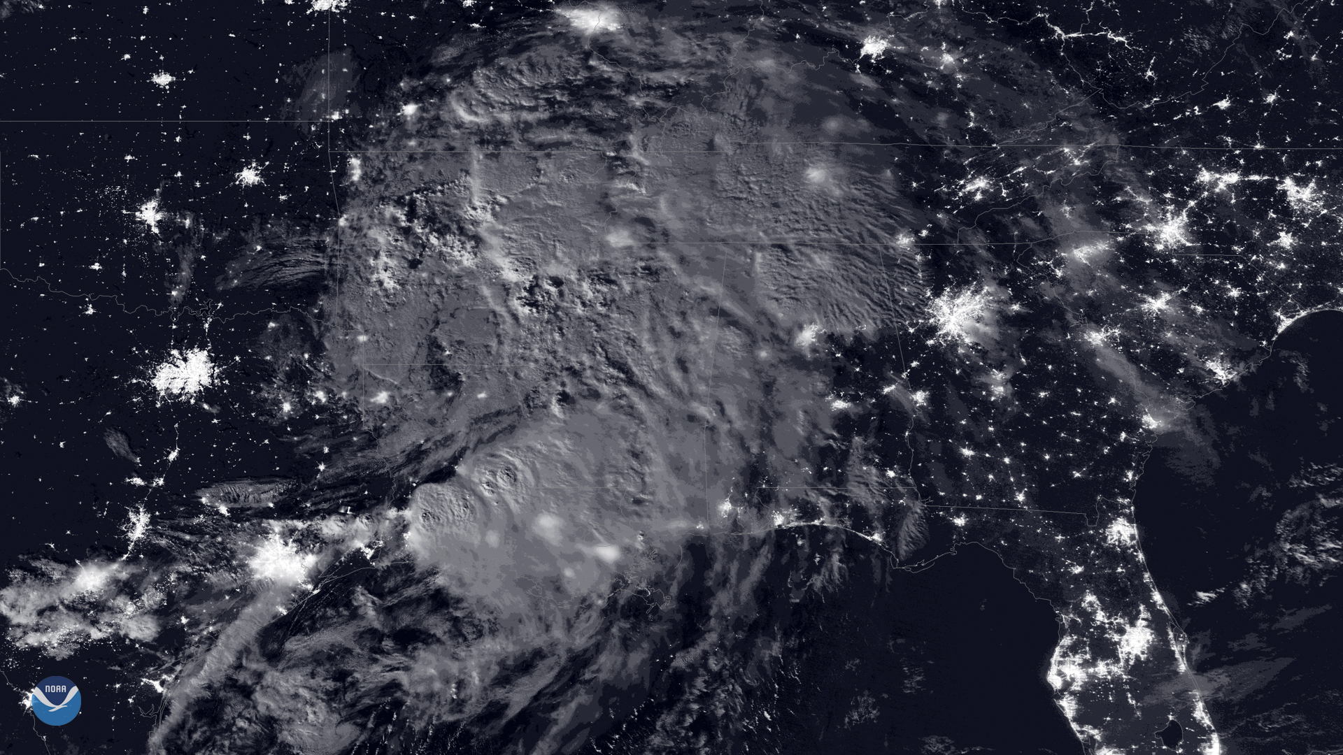
A nearly full moon made it possible for the day-night band of NOAA-20 's Visible Infrared Imaging Radiometer Suite (VIIRS) to capture this view of Tropical Depression Barry early Monday morning. Barry slowly lifted north across the Mississippi Valley on July 15, 2019, where the system continues to produce very heavy rainfall that could trigger significant flash flooding in some areas.
Barry is expected to unleash “additional rain accumulations of 2 to 4 inches with isolated maximum amounts of 8 inches across Arkansas, western Tennessee and Kentucky, southeast Missouri, and northwest Mississippi,” according to the National Hurricane Center’s 11 a.m. update. As Barry moves further inland, it is expected to weaken, eventually becoming a remnant low.
The VIIRS day-night band layer is created using a sensing technique designed to capture low-light emissions under varying illumination conditions and is displayed as a gray-scale image. A higher signal-to-noise ratio compared with the Suomi NPP satellite's day-night band results in sharper imagery.
Where this page came from
This page was imported from NOAA Satellites (NESDIS). Published by NOAA's National Environmental Satellite, Data, and Information Service and, as a work of the United States government, in the public domain; pictures credited elsewhere are left out.
Nobody has written it yet — it is the source material at a new address, which is why search engines are asked to skip it and why no one earns from it. It is up for grabs: take it on, and it is yours to rewrite and to earn from.
许可协议: CC0 1.0(公有领域) · 改编自 www.nesdis.noaa.gov
1
0
0
0

留言