Download Image Download Image of Mount Agung
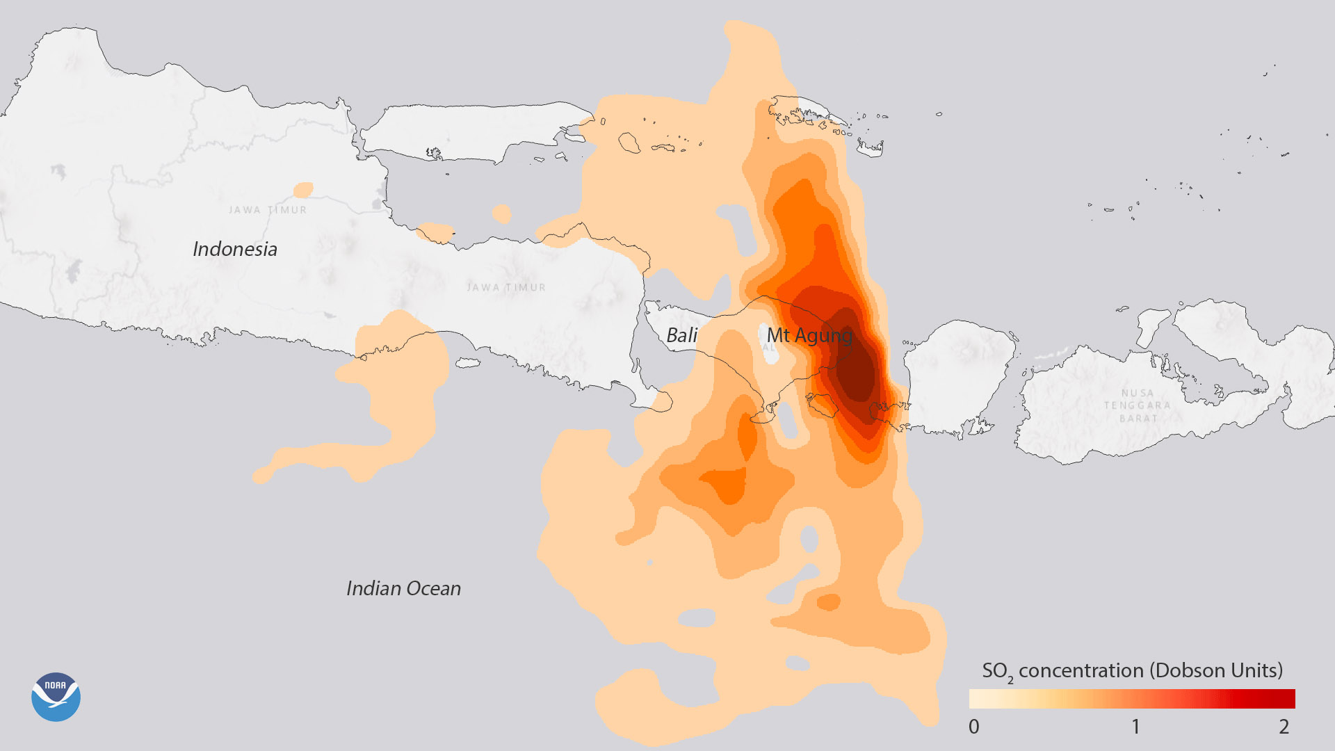
Data from NASA’s Aura satellite shows the high sulfur dioxide (SO2) concentrations associated with the volcanic eruption of Mount Agung in eastern Bali, Indonesia, on Monday, November 27, 2017. Prior to and during eruptions, volcanoes like Mount Agung release large amounts of SO2 into the atmosphere, which can act as an early warning. After being released, SO2 can be transformed into tiny sulfate aerosol particles, where they can alter the brightness of clouds and affect regional precipitation patterns.
NASA Aura's ozone monitoring instrument can help track the movement of the volcano’s ash cloud by measuring levels of atmospheric SO2 concentrations in the vicinity of the eruption. NOAA provides this data to the Volcanic Ash Advisory Centers around the world, which use the information to reroute air traffic away from dangerous ash plumes. As of Monday morning (ET), the highest concentrations of ash were found just east of Bali.
The eruption of Mount Agung, which began last week, has forced more than 100,000 people to evacuate. The last major eruption occurred in 1963.
Where this page came from
This page was imported from NOAA Satellites (NESDIS). Published by NOAA's National Environmental Satellite, Data, and Information Service and, as a work of the United States government, in the public domain; pictures credited elsewhere are left out.
Nobody has written it yet — it is the source material at a new address, which is why search engines are asked to skip it and why no one earns from it. It is up for grabs: take it on, and it is yours to rewrite and to earn from.
Licence: CC0 1.0 (public domain) · Adapted from www.nesdis.noaa.gov
1
0
0
0

Comments